I headed out to hike a section of the PCT that’s widely reviled as being “ugly.” I like it – not for its soul-inspiring views or quiet solitude, but for what it represents.
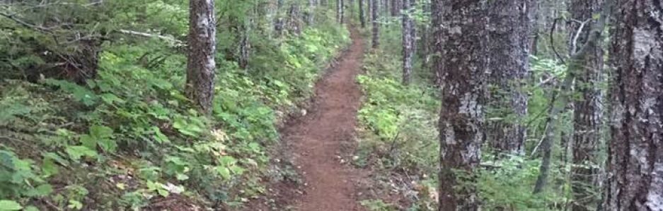
This section is the 10 1/2 miles between Stampede Pass and Tacoma Pass. It has a decidedly ‘industrial’ feel to it. Just south of Stampede Pass, the trail crosses three clear-cut areas under high-voltage power lines. A hiker crosses about a dozen roads – some of which are abandoned, but still clearly roads – and there are remnants of logging operations lying about. (I’ve seen 1″ steel cables in several places. My favorite “artifact” was the mudflap from a Kenworth tractor that way lying by the trail for several years.) There’s one spot where there’s a broken electrical or telecommunications cable sticking out of the ground, near a partially-buried “Underground Cable” sign. The pristine High Sierras this ain’t.


So why do I like this section? One, I know it. I’ve hiked it several times. There’s a lake about a quarter-mile from the Stampede Pass trailhead, there’s a reliable spring about halfway to Tacoma Pass, and about a half-mile south of Tacoma Pass there’s a reliable stream. It’s comforting to know where the water is. (South of the stream near Tacoma Pass, it’s twelve miles to the next water source.) Because of all the abandoned forest roads, there are plenty of places to camp if you’re sleeping on the ground. It’s not great for hammocks as the majority of the trees are subalpine pines. (Their branches tend to closely set & closer to the ground, and their trunks are covered in pitch pockets that easily pop open – if you’ve not put a barrier between the tree and your hammock’s hang straps, you will find them to be a sticky mess by morning.)
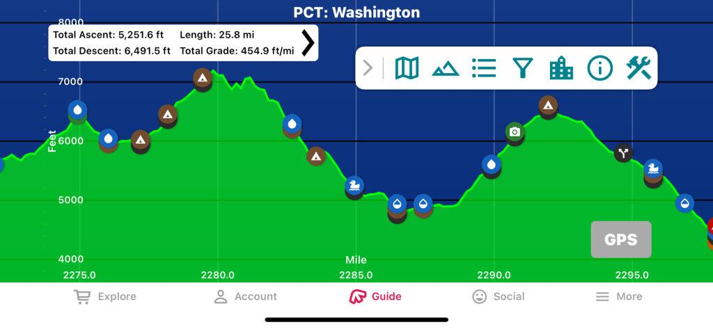
This section of the trail is also a great workout. I think it’s the hardest 10 miles of the PCT in that I’ve hiked in Washington State. (I’ve done about half: from Stevens Pass south to Bridge of the Gods, minus the part between Walupt Lake and the southern end of the Mt. Adams Wilderness. The “easy” parts. 😉) According to the FarOut! app, this section’s total grade measured as ft/mile is 487. (The southern half is 505’/mile.) Goat Rocks Wilderness – the hike that kicked my butt last August – is 454’/mile. (It’s also a few thousand feet higher above sea level than Tacoma – Stampede, and that didn’t help this body that resides at 400′ above sea level.) Sections K & L – the wild lands north of Stevens pass – are 416’/mile. Those other areas have special challenges that make them hard, but the grade is easier.


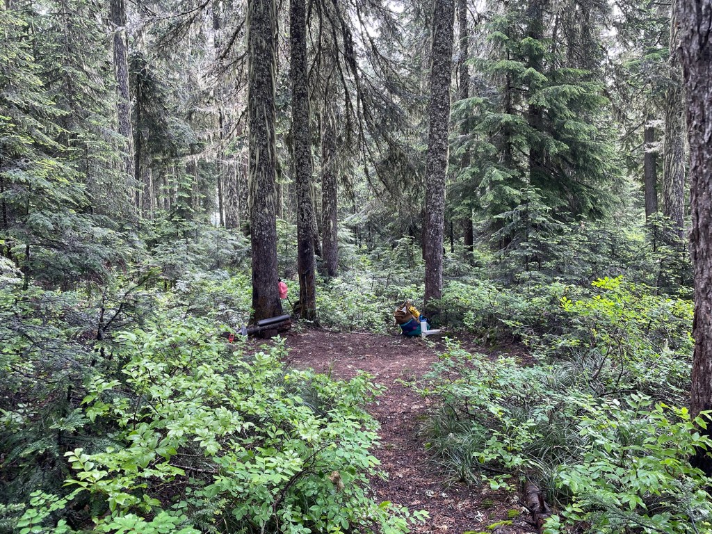
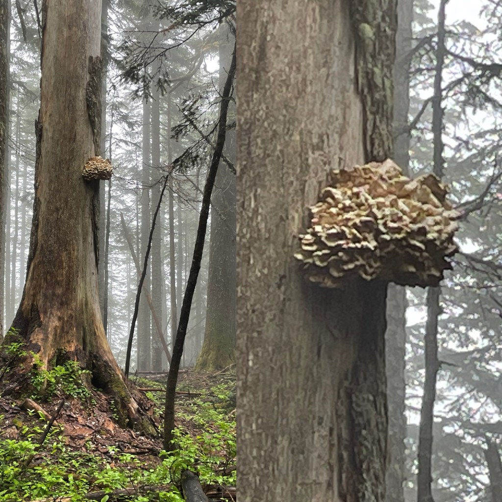
It’s easy to get to — nearly the entire drive is on the interstate, and the gravel road to the trail head is in pretty good shape — and the snow tends to melt relatively early because this area’s elevation is moderate. It also has some very lovely spots, and I’ve taken two of my favorite trail pictures in this area (below).


I got a late start on this hike, and that seems to be a pattern I’m hoping to break with my next hike. The days are fairly long right now, so I figured I had plenty of time to hike. But the day was cool, and I decided I wanted to be camped well before sunset. I noticed the place where I camped a few years ago & put a note in the FarOut app that it’d be a good tent site, not so great for hammocks.
I’d brought along my Gatewood Cape & the inner net tent that goes with it. I have another tent I prefer when I have to sleep on the ground, but I want to try using the Gatewood cape to see how comfortable I am with it as a shelter. I love the idea of the cape for rain protection if it’s ever really pouring down rain, and if I can use my rain protection as a shelter, that saves a bit of weight from the pack – bonus!
It’s a good thing I stopped early because I had to futz with the cape several times, and I still didn’t get set up right. I brought along a tent pole to try with this set-up, and it set the peak of the cape too high. (I believe I should have tried angling it; next time I’ll do that.) I ended up using my trekking pole instead. I adjusted the stakes repeatedly and it still never seemed “right.”
I slept poorly. My watch thinks I slept about four hours that night. I thought I got more sleep than that, but it wasn’t great. My feet were cold all night. I was wearing wool foot sweaters (socks knit by my Mom), and they usually keep my feet very happy. In the morning, I discovered why my feet suffered all night: the footbox of my quilt was wet. Because of the steep slope at the head & foot ends of the cape my feet brushed up against the tarp. It rained during the night, and there was a lot of condensation on the underside of the cape. Another example of why I need to figure out how to set this thing up properly, and I need to do it so many times that I don’t have to futz with it for an hour.
As I ate breakfast in the morning’s chill, I pondered my day ahead. I thought about heading back north and hiking north of Stampede Pass instead of heading south to Tacoma Pass. I decided against that because I feared the temptation to stop as soon as I saw the truck would be too strong. I decided I’d head toward Tacoma Pass, drop my pack at the road & hike unencumbered to the stream, then head back to Stampede Pass. I figured that it was possible I could get back to Stampede Pass late Saturday, and if necessary I’d camp in the truck instead of trying to drive home that late. (I have the truck’s bed set up so that I can sleep in it, and I have a tent that attaches to the back of the truck bed.)
But because the morning was so cold, I hadn’t crawled out of the tent until after 8, and I didn’t get out of camp until around 10 a.m. Given that I was averaging less than 2 mph while hiking, that the total grade of the round-trip to Tacoma Pass & my campsite is 505’/mile, and that I would need to tack on a mile round trip to get water, this was looking like a very long day indeed. I was doing all this pondering while I was hiking south. I decided to take break and spend a few minutes deciding what I wanted to do.

I headed back north toward Stampede Pass. Given that my quilt’s footbox was wet, spending another night on the trail would have meant another night of cold feet unless I was able to find a warm, sunny spot to try to dry out my quilt. (Given that it would require a long break (an hour or more), it didn’t seem likely that I’d find time to do this.) It felt like a defeat, and I started wondering if attempting to hike through Oregon next month is a good idea. I briefly pondering deferring this trip to next year, but I quickly rejected that idea. While the trail will always be there, there’re no guarantees. Something catastrophic may happen. Even without that, there’s no guarantee I’d be in top physical condition next year.
Then I realized that with a month to go, I still have time to improve my cardiovascular & muscular endurance. I’ve started going to the gym a few nights a week and walking on the treadmill with an 18-pound pack & the grade set at 5%. I’ve also been doing backpacker-specific recommended strength training. Every little bit helps!
I’m heading out again this next weekend. I’ll likely take the hammock. I don’t plan to use the Gatewood cape when I hike Oregon, so getting practice using it isn’t time-critical. There are likely places in Oregon that I may not be able to find a place to hang, but I’d rather be comfortable 90% of the nights even if means risking having be very uncomfortable sleeping on the ground a handful of nights. (I’m going to be very slow compared to the thru-hikers that go speeding by me, and I don’t want to have to ‘race’ to find a spot to set up a tent. I also don’t want to find the last campsite for miles is already full.)
