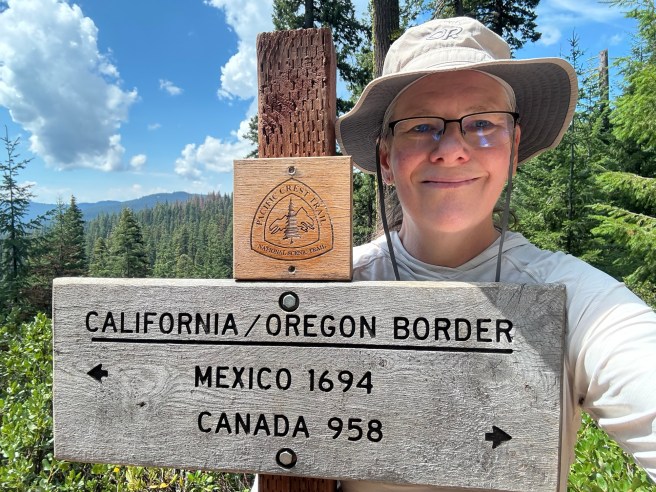
Last year, I decided that I’d hike the Pacific Crest Trail through the State of Oregon to celebrate my 60th birthday. The PCT covers about 460 miles as it makes its way from the northern border of California to the Bridge of Gods over the Columbia River. Assuming one “zero” day for every 4-5 hiking days, covering that distance in one month means hiking an average of 18 miles/29km a day. In a normal year, that would have been a stretch but still do-able because of some of what makes Oregon unique among the PCT’s regions. Alas – 2025 was not a “normal” year.
So What’s Unique About Oregon?
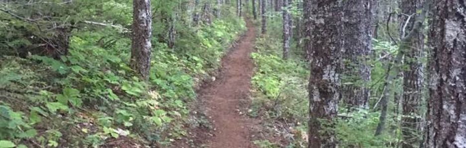
Thru hikers refer to Oregon as The Green Tunnel and will state – with a straight face – that it’s flat. It is neither. But when one compares the elevation gain & loss and the average grade, the PCT along Oregon is much gentler than Northern California and the State of Washington. Going northbound, the elevation gain and loss through Oregon 73,225′ (up) and 74,520′ down; the average grade is 5.7%. A NOBO going though Washington will gain 102,300′ and lose 98,130′ over the trail’s 505 miles. The average grade is 7.5%. That means the effort of dragging one’s self up the hills in Washington is about 25% harder.
The terrain itself is another factor. Where the PCT crosses from California into Oregon, the elevation is 6,000’/1830m above sea level. The trail gains another 1,000’/305m over the first three miles, and then the trail kind of bumps along, gaining & losing elevation in a comparatively gentle manner. The trail doesn’t get below 4,000’/1220m until 372 trail miles (600km) later. There are steep bits in Oregon, and there are climbs & descents, but they’re not the long descents into river valleys followed by steep climbs back up over the next ridge like Northern Washington State, or the “Welcome to Washington” punch in the throat that is the climb from the Columbia River – the lowest elevation on the entire PCT at 77’/23m above sea level. (Pity the poor SOBO who makes the same climb but on the Oregon side of the river. Much of the 11 mile/18km climb from the river is an 11.5% grade. That’s stoopidly steep, and it going on & on for 11 miles is just plain mean.)
One reason Oregon’s PCT is so high and stays relatively high is that much of the trail is based on the old Oregon Skyline Trail. Also, the designers/designators of the trail were able to keep the trail close to the crest through much of Oregon. They couldn’t do that as easily in Washington because of the difference in topography. The trail goes around Pahto (Mt Adams), Tahoma (Mt Rainier), and Dakobed (Glacier Peak) instead of trying to stay closer to their peaks. It traverses the flanks of Pahto and Dakobed, but there’s a lot of elevation gain & loss (over & over, over & over) near Dakobed. While most of the trail between Trout Lake and Snoqualmie Pass is over 4,000’/1220m, the average grade is about 6.5% — there’re still a LOT of ups & downs as one goes over the hills and through the woods…
I’ve even heard thru hikers call Southern Oregon “boring.” *gasp* That’s a bit unfair. NOBOs have just left the majestic Sierra Nevada and the majesty of Northern California’s Lassen Volcanic National Park and stunning state parks. I’ve hiked almost all of the PCT in Washington State south of Stevens Pass, and there are some unlovely parts. There’re a few bits I’d rather not hike again, ever. There’s an area I really like that a lot of PCT hikers detest – just south of Snoqualmie Pass. It has an almost industrial feel to it — a hiker will find lots of artifacts left behind by past logging operations and telecommunications companies running cables. But two of the best pictures I’ve taken along the trail were spots between Tacoma & Stampede Passes. And I love that short section because it’s easy to get to, it makes a great ‘training’ hike, and I’ve hiked it enough times that I know where the camping spots are. When folks “warned” me about the Green Tunnel, I just smiled. And as it turned out, a lot of what I saw in Oregon reminded me of parts of Washington.
So Why Was This Year Not a “Normal” Year?
I cannot complain about the weather or fire conditions as I got very lucky on both counts. But the year leading up to my August 1st start day was a rollercoaster ride.
First, in August 2024 my doctor recommended I go on phentermine. This doctor has since retired, but in the entire time he was my doctor he mentioned my weight just twice. Once was to suggest that if I lost ten pounds I may find I didn’t need my blood pressure medication. The other was in August 2024 when he told me he was concerned about my weight gain. I’d gained 30 pounds over eight years. While that’s just 3.5 pounds a year, it’s the first time in a very long time my weight has just gone up & up. It wasn’t the only issue, either — if it was, he probably wouldn’t have said anything. I’d had a second bout of COVID-19 in July 2023, and since then I’d been dealing with a lot of fatigue. My body being 190 pounds but being fairly active is one thing; being 190 pounds and inactive is worrying. (I have a strong family history of Type II diabetes, and when I’m carrying that much extra body fat and not exercising, I edge into metabolic disorders that have long-term poor health outcomes.) I wanted to deal with the fatigue. I also mentioned the executive dysfunction that seemed out of control since that 2023 COVID-19.
So I went on phentermine. The good news is that it did enable me to lose the extra body fat, and it enabled my doctor to diagnosis me with ADHD (at age 59!). The bad news is that I am allergic to that class of medications. For the first six months, the allergic response to phentermine was manageable and it was worth staying on for the overall benefit of getting rid of the unhealthy amount of fat I was carrying. Then, suddenly, it wasn’t manageable. My mouth erupted in sores & blisters. It severely limited what I could eat. That may sound like a weight loss bonus, but it meant my diet went from being varied & healthy to neither of those things. After a few months off phentermine, I tried Ritalin. Unfortunately, I had the same response as I did to the phentermine, but this time it hit me after a week. (But oh! I was focused & on top of things for that week. It was nice.) This time, the reaction was quick & severe. The urgent care clinic treated it with a steroid to calm down my immune system’s allergic response. Alas – it calmed it so much that I ended up with thrush and a staph infection in my mouth. That was a difficult month.
I’d also had emotional & mental health issues that just made it difficult for me to get out hiking on my time off. I can’t really pinpoint why. I was excited by this trip, but I frequently found myself getting overwhelmed. This response surprised me because I often enjoy planning these hikes almost as much as I enjoy the doing.
I was able to get a few weekend hikes in. I knew I was going to be slow both because of the elevation of Southern Oregon and my lack of physical fitness. Several weeks before my start date, I decided to focus my energy on prepping & mailing my food resupply boxes. Whether I was in great shape or terrible condition, I’d still need to eat. Thus, those boxes became my priority.
And then, a week before I was due to leave, I got sick. I tested for COVID-19 and influenza, and the tests were negative. It was just some nasty rhinovirus that attacked me. But my permit stated I had to start on August 1st at Donomore Pass … so I did.
We checked the pup into his kennel the morning of July 31st. I was running behind on everything, so we didn’t get out the door until mid-afternoon. I’d made a reservation at a hotel a ways away from Ashland for that night. We got there late, but I knew I wouldn’t sleep very well that night regardless.
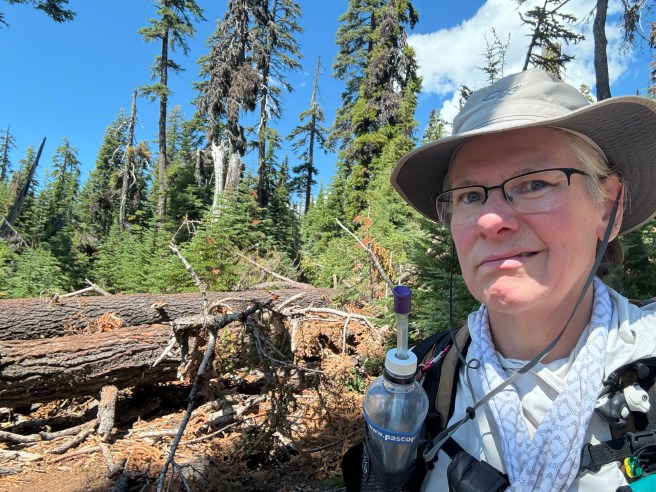
The next morning, we drove to Donomore Pass. The CA/OR border is about a third of a mile south of the road. We arrived where the PCT crosses the road. I took my time getting my pack set up. Jim hiked with me down to the state border & back to the truck. It was a bit past noon when I took a long drink of ice water, put on my pack, and headed north.
The Adventure Begins!
I’m glad I knew ahead of time the elevation would take a toll on my body. It kicked my butt. I’m also glad I decided ahead of time that I’d accept 5-10 mile days the first week or so because on the first day I did about five and a half miles.
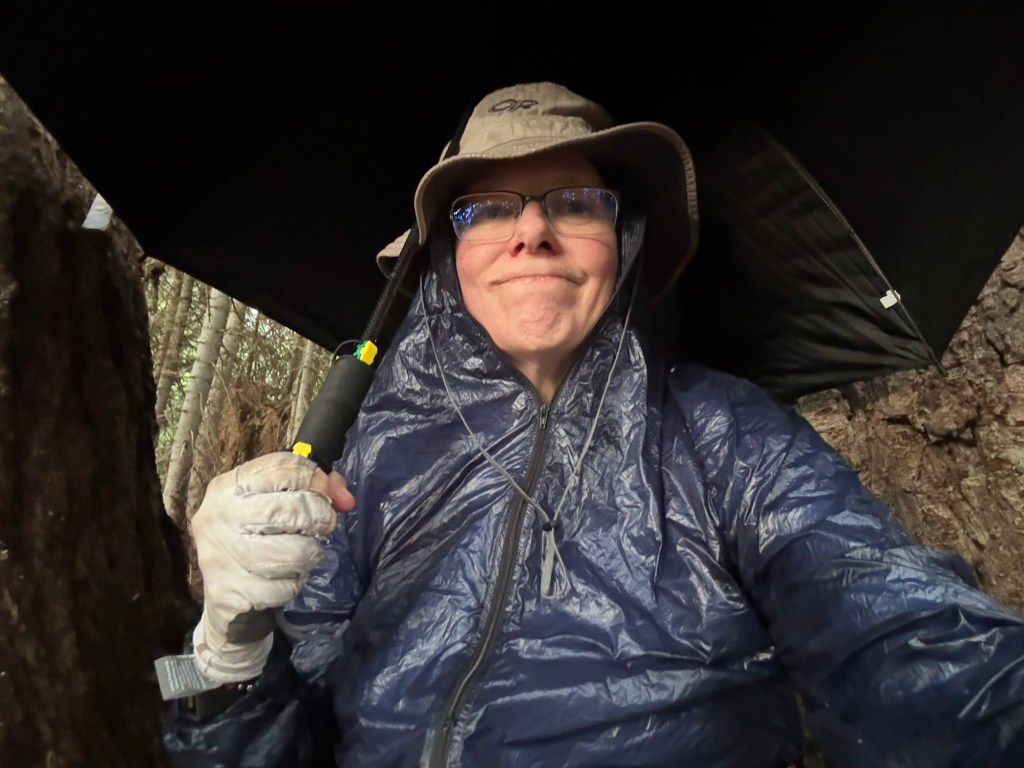
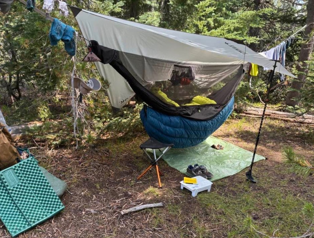
I always check the weather before heading out, and my Garmin InReach allows me to check the weather from the trail. I do not recall any mention of thunderstorms in the forecast. My biggest memory of this day was a whale of a thunderstorm. I was a few miles in when I began hearing rumblings to the south of me. They were distant enough that it caused no concern. Over the next few miles, I could tell the storm was getting closer, but it sounded like it was west of the crest. A few times I heard distant rumbles to the east, but that wasn’t enough to trouble me. In a fairly short period of time, the storm gained on me. I could hear the thunder was closer, but I wasn’t seeing lightning. It started to drizzle. At this point, I recognized the flaw in my rain gear: instead of wearing a jacket, I carry an umbrella. It’s carbon fiber and there’s no metal on it, but I didn’t want to be walking along a ridge at nearly 7000′ above sea level holding anything over my head.
I stepped under a tree to ger my windshell out of my pack. It’s not waterproof, but it’s water resistant. It wasn’t a hard rain, and I figured it & my hat would be enough to keep me from getting soaked. I hoisted my pack back onto my shoulders and turned to toward the trail … and saw that it was now hailing. The hail was coming down about as hard as it can in the Pacific Northwest. This isn’t Midwest, golf ball-sized hail that destroys crops and beats up car hoods, but it was a lot of hail & it was coming down hard and fast. The trail was covered in white. I rolled my eyes, muttered some curses, and took shelter in the grove of trees adjacent to where I stopped to put on my jacket.
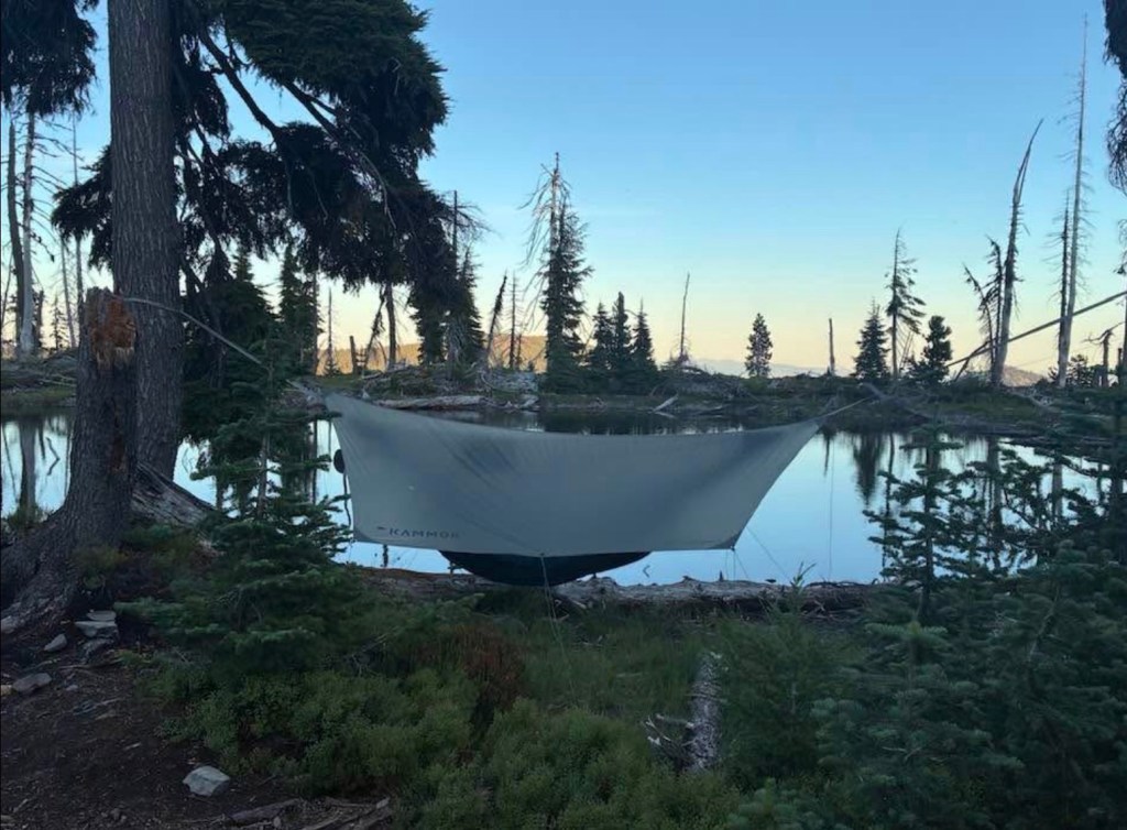
This grove was almost ideal. The trees were large – both very tall and very sturdy. The grove was big enough to provide protection from lightning, and the trees’ branches kept out most of the hail & the rain that followed. I still needed to use my umbrella to keep the rain off of me, but I found a comfortable spot to sit and pass the time.
I began to consider making the grove my campsite for the night. There was a spring a half mile or so back. I saw what looked like a good spot to string up my hammock. But then I looked up. There were at least a half dozen dead branches about the size of my leg over the area I would have been sleeping. This storm was clearly a big one, and I didn’t to risk one of those things landing on me. I started pondering. I finally decided that my risk of being hit by lightning was far lower than my risk getting whacked by a widowmaker. I decided to head north on the trail.
Fortunately, the worst of the rain had passed. I hiked in a drizzle. There was still lightning. Most of it was some distance away. There were occasional flashes simultaneous with the thunder, and I saw a couple of flashes in the immediate area. But I never felt my skin tingle — at no point was I in any danger of being struck by lightning. Although it was raining, the air temperature was comfortable, and I was dry enough that I was able to enjoy the spectacle of this majestic display. (There were a fair number of hikers between Seaid Valley and Donomore Pass who were caught in that storm and were absolutely miserable. Some were running for their lives because there was no cover. Some got soaked to the bone. They did not enjoy the spectacle.)
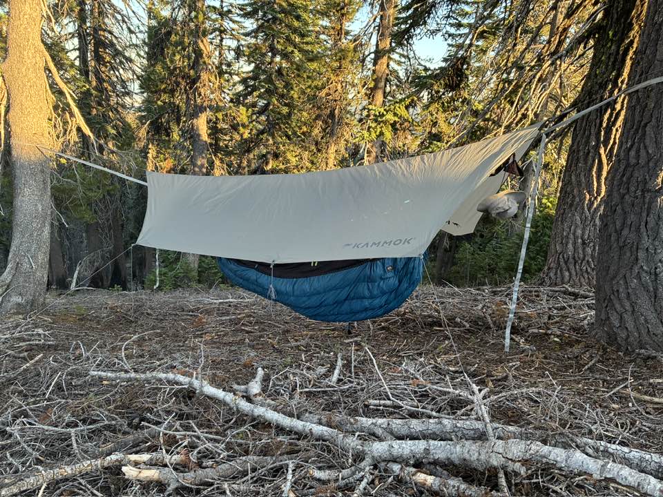
I knew good hammock spots might be scarce though this area, so when I found and acceptable spot with no widowmakers I decided that was it for Day 1. There was nothing remarkable about this spot. It was not-quite flat — I look for that, because it means I’m not taking a spot someone sleeping in a tent will use. It was near the trail but because of the slope and the trees in the area it didn’t feel exposed.
I wrote no notes about the trail in my journal regarding my second day. Thus, I have no memory of the specifics of that day. It’s a pity, because I was enjoying myself despite the reduced oxygen levels and my limited physical endurance. I have some pictures in my head that may have come from Day 2; unfortunately, I have no way to share them.
I camped just past Long John Saddle near a reliable stream. There were a good number of folks closer to the stream, but I opted to camp several hundred feet away. I hung my hammock just downslope from a decommissioned road. The spot where my hammock hung was a bit too steep, but I wanted to be a good distance from other people. I woke up coughing frequently during the night. Thru hikers are generally heavy sleepers, but I also didn’t want to be memorialized in someone else’s trail journal as “that hiker that kept me awake because of their coughing.” It was nice having the flat area of the roadbed as my camp area
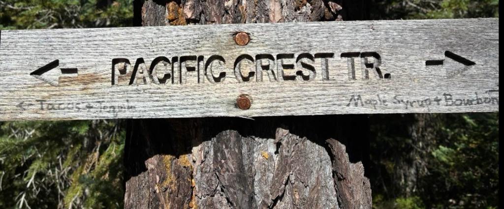
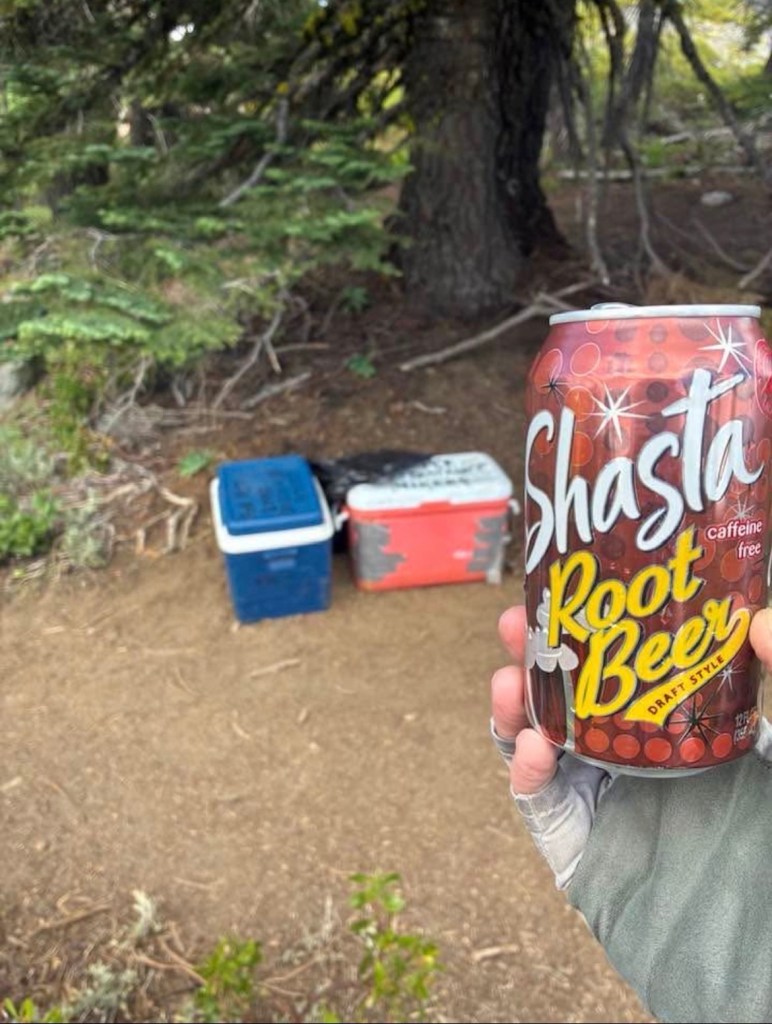
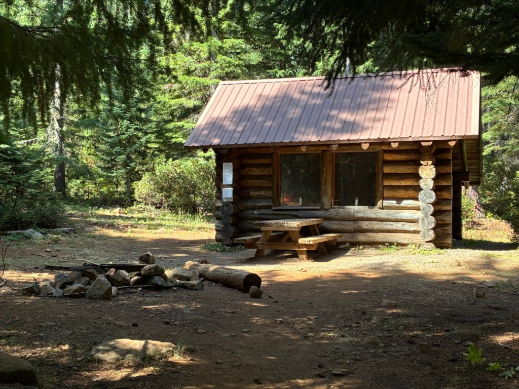
My third day was just as slow as the previous two, but it was a treat. I hiked along Mount Ashland. The Mount Ashland Road roughly parallels the Pacific Crest Trail in this area; when the PCT is covered in snow, many hikers opt to hike along the road instead of slogging through the snow. The other advantage of being so close to a frequently-traveled road – TRAIL MAGIC! There was a spot about 50′ from the road where the trail passes a grove of trees. Some kindly soul put a couple of coolers of ice-cold beverages and set up beach chairs in the shade for long-distance hikers. As I chugged my frosty root beer, I chuckled as another hiker read through the nutrition facts labels of the various sodas and yelled out “Yes! 43 grams of carbohydrate!” (Protein and fat are important, but carbs rule out here.)
While planning this hike, I’d decided that I was going to do all the off-trail stuff I wanted to do while in Southern Oregon. I figured that it was more important to me to make memories on this trip, and given that it’s less than a 3-hour drive to Cascade Locks it’s far easier for me to do parts of the Northern Oregon PCT on weekend or week-long getaways. I promised myself that I was going to bag all the peaks and take all the scenic detours because it will be a half-dozen years before I have another opportunity like this. Alas, my relatively poor physical fitness changed those plans. While hiking by Mount Ashland, that meant I skipped the brief detour to climb to top of Siskiyou Peak. That short, steep climb will have to wait.
The slopes through which I was passing were covered in wildflowers. It was beautiful. But the butterflies took my breath away. There was an exceptionally large “bloom” of California tortoiseshell butterflies in 2025, and while hiking across one open meadow wave after wave of hundreds, maybe thousands, of them passed by me, flying up the slope. I stood there motionless for several minutes while one wave after another approached me, with dozens & dozens of butterflies changing course in the last moment to avoid crashing into me. It was magical moment that may be a once-in-a-lifetime experience for me. (No picture of the squadrons of butterflies, I’m afraid. There’s just no way a photo I snapped with my phone would have captured what I saw.)
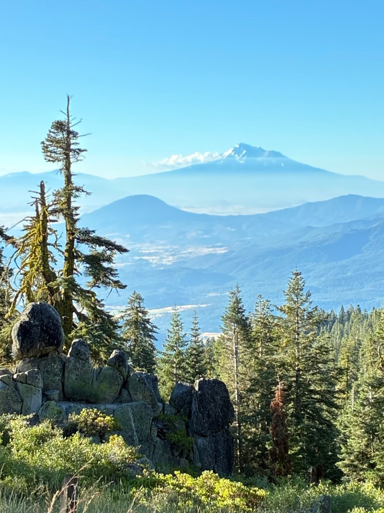
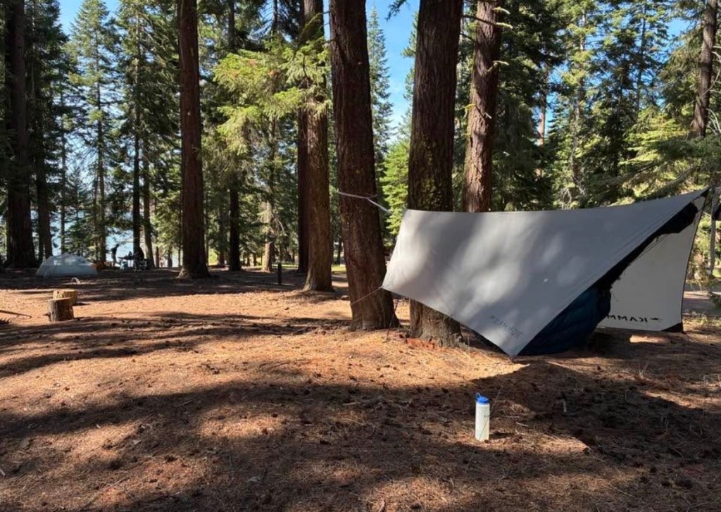
I initially thought I might hike straight through to Callahan’s that day – 13-ish miles – but I opted for a shorter day. I camped at the Mount Ashland campground. It’s a car-camping campground, but hikers easily outnumbered the folks who arrived in a vehicle. From my campsite, I had a good view of Mt. Shasta to the south. (Mt. Shasta is easily visible for about the first 100 miles of the PCT in Oregon.) The most memorable thing, though, was the wind that night. Fortunately, I’d opted to secure the upwind side of my tarp to a downed log & a fireplace grate instead of staking it to the ground. The wind blew so hard that night it pushed the tarp into the space over my body & face. It felt more claustrophobic than being in a tent — it felt like I was lying in a bivy sack. I’ve never seen that happen, and if my tarp hadn’t been secured the way it was I imagine it would have been flapping in the breeze.
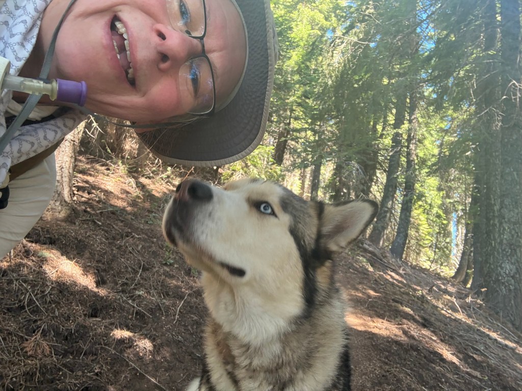
My fourth day was almost an almost entirely downhill hike to Callahan’s Mountain Lodge along Interstate 5. The scenery was less impressive than the previous days’, but it had its own rewards besides getting to Callahan’s comforts. In this area, the PCT passes through what used to be the Mount Ashland Inn. It’s now a private residence, but the owners tolerate the trail’s right of way through their property. They’ve even set up a picnic table & a potable water spigot for hikers. But my favorite thing along the trail that day was meeting one of the most famous PCT hikers in Oregon. He’s famous even though he hikes the same short section over and over. Why is he famous? Because he’s a dog. The former inn’s owners have a large husky who hikes back & forth, escorting hikers through “his” property. He’s friendly but not overly so – I’ve no doubt he’s ensuring we don’t trespass. He let me take a selfie with him — he really was the highlight of my day!
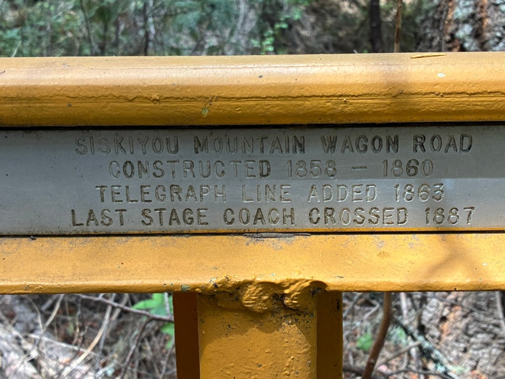
Getting to Callahan’s is a short detour off the PCT. The good folks at Callahan’s make sure you don’t miss the turn-off; there’s a large sign pointing the way. This area includes a section of the old Siskiyou Mountain Wagon Road, built about 150 years ago. I passed a marker for the old road describing that the road was built between1858-1860, that a telegraph line was added in 1865 — the poles were still visible in that area — and that the last stagecoach crossed in 1887. (The marker described in the link is not the same one, based on the picture of it on that webpage. But it’s close to the area where I took my picture. This page has a brief description of the history of the road.)
Given that Callahan’s is less than 30 miles from the border, and Fish Lake – the next place a hiker can pick up a mailed resupply box – is just 80 miles from the border, with better overall fitness I might have opted to bypass Callahan’s altogether. I’m glad I didn’t — Callahan’s is a gem. The staff is very hiker-friendly. (While I was filling up at their breakfast buffet – included in the price of the room – the front desk clerk came into the dining area to announce a there was a ride to Ashland available that would be leaving in about 15 minutes. She didn’t have to do that, and I thought it was a nice gesture.) Because of this, they get a lot of hiker traffic. They have laundry facilities, a shower, a hiker box, and for a reasonable fee they allow hikers to camp in a grassy area in the front of the motel. I opted for a room. My room was a “basic,” according to the front desk clerk. It was on the floor below the main entrance, and when I headed into what looked like the basement I chuckled because I figured they put the hiker trash where no one else wanted to be. Boy howdy was I wrong. My room looked out onto the expansive lawn at the back of the lodge. There was a large water feature with a waterfall & pool just outside my window. My room had a door that opened out to this area. The room was small, but it had a jacuzzi. It was lovely.
I switched over to my sleep clothes, took my very dirty clothes to the laundry to start them washing, and then took a very long shower. The temperatures had been mild, but the trail is very dusty. I rinse off or wipe off my legs & feet before I get into my hammock at night, but that’s no substitute for a good scrubbing! I then went to retrieve my resupply box. It’s a little thing, but picking up a resupply box made me feel like a “real” long-distance hiker. (None of my previous hikes have been long enough to require resupply.)
I still had some food left — I tend to over-pack food — and there was more than enough in my resupply. (I was having trouble eating enough.) I left a bunch of commercially-packaged things in the well-supplied hiker box. I then headed to dinner. I opted for their house spaghetti. It was quite tasty. I drank a beer with dinner even though I knew that was a mistake. (I sleep poorly even if I have just one alcoholic drink. It sucks.)
My sleep was crap. I spent much of the night coughing, and because I had that beer what sleep I got wasn’t very restorative. I feared the exertion of what little hiking I was doing, combined with the elevation, was grossly delaying my recovery from whatever rhinovirus I’d contracted. But onward we go…
It was easy to pick out the thru hikers & long-distance hikers in the dining area. Clean but tattered clothing, trail runners or camp shoes, plates piled high with pancakes, hashbrowns, fruit.
Leaving Callahan’s, the hiker climbs alongside I-5 until reaching where the official route of the PCT crosses the Siskiyou Hwy. The trail heads east, and the flora reflects the drier climate of this side of the mountains. I crossed through scrub oak plains and open range land; but for the fences and the gravel roads, I imagine the landscape looks much like it did a millennia ago.
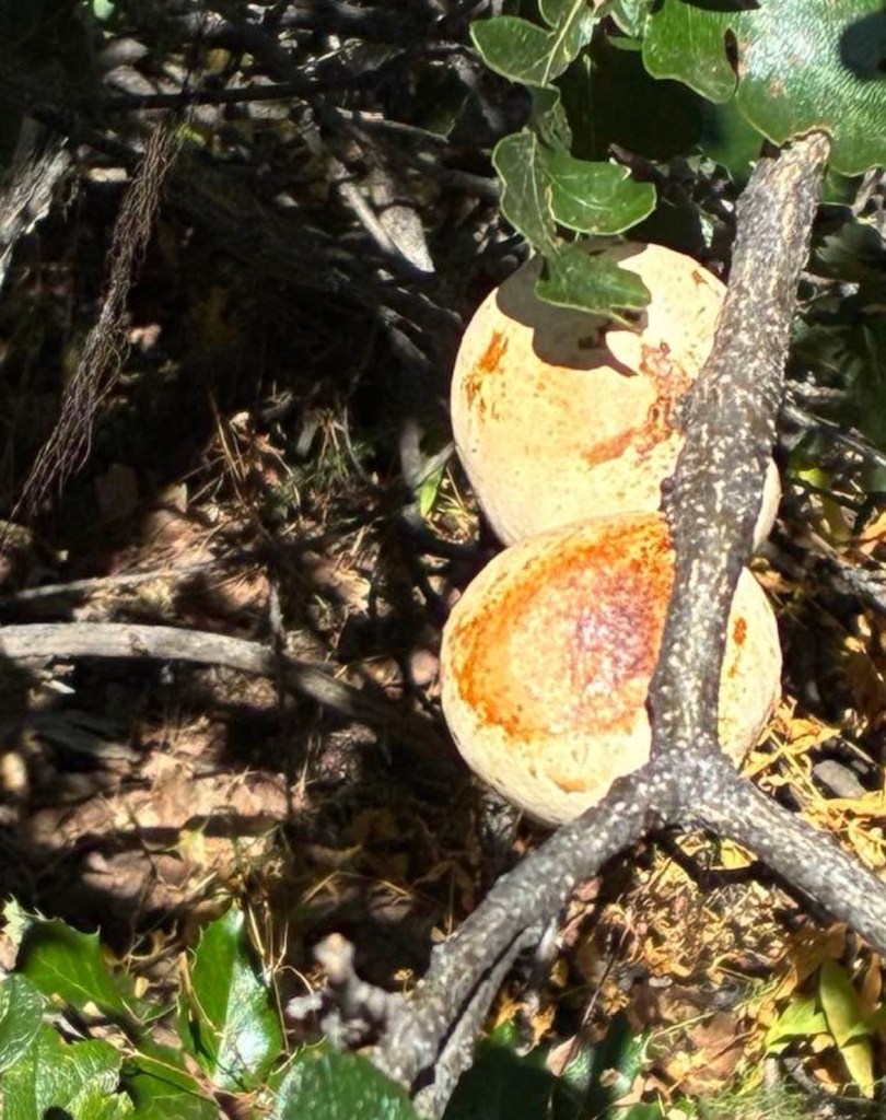
I don’t believe I’ve had occasion to hike though oak groves before, and this hadn’t occurred to me until I realized almost all the trees around me were oaks. I saw lots of oak apples – something I don’t believe I’ve ever seen, either. (I was not tempted to eat them. 😆)
This area is dominated by views of Tans-ts’atseniptha (“rock standing up”), named Pilot Rock by later arrivals. I took a break at the trail junction to this landmark. I chatted with a hiker who told me she was thru-hiking the PCT solo to celebrate her 50th birthday. She was having an issue charging her phone because her charging cord wasn’t working. A had a compatible cord, so I let her use mine for the few minutes we were both there. She was planning to camp that night in the same area I hoped to make it to, so I let her know if I got there she could borrow my charging cord overnight.
I pushed myself to get to that spot, as I know what it’s like to have to ration power on my phone while I’m hiking. Smartphones have become our cameras, our primary navigation tool, our books — they quickly become essential on the trail, and while I can survive without mine it makes like much easier & more pleasant. There is a spring at that spot, and this very dry terrain. Not only did the spring mean not having to worry about water, it meant I got to watch wildlife from my campsite. It was worth the extra effort to get there.
My campsite wasn’t ideal, but it was late when I arrived and I didn’t want to waste daylight in the hope of finding something better. My cough was a little better but I still spent much of the night coughing. I slept poorly, and the consecutive nights of non-restorative sleep, the illness, and physical exertion at an elevation to which my body is unaccustomed were taking a toll.

I woke up not long after sunrise, but I didn’t get out of my hammock until seven. My body was drained, and I had no interest in pushing myself any harder than necessary. I wasn’t in poor enough shape to turn around and return to Callahan’s, though. I hiked – slowly – to the next spring, just two miles up the trail. I stopped for a break, and I decided to eat lunch and take a nap. Even before I got into my hammock for my nap I was already convinced this was the perfect spot for an on-trail nearo.
The thru hiker with the phone cord issues was here briefly as well. I mentioned thinking of taking a nearo here. She said she was struggling with how warm it felt. She’d skipped from the Sierras to Oregon because of her time constraints as she was here on a tourist visa, and it was much warmer here than the Sierras had been. She left, but she was planning on taking a short day as well. She saw the wisdom of easy days, pointing out that sometimes taking a day off can save you from having to take three days off to recover later.
Among my neighbors that night were Jumpscare and Cannonball. Cannonball is much younger than I but she’s a hammock sleeper because of a bad back. (Jumpscare is a groundling.) It’s a rarity to see another hanger on the trail! I was pretty soundly asleep when they arrived because I didn’t hear them even though they were within 10′ of my tent. I’m grateful I took the short day & the chance to recover a bit!
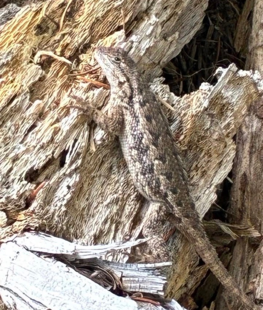
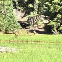
This day took me around Hobart Peak & Hobart Bluff, through bunch of private property — I was literally walking though people’s backyards — and through an area that had burned just few weeks before. My plan was to hike to the Hyatt Lake recreation area with a brief detour to Keene Reservoir for water. I saw a bunch of western fence lizards (yes, that’s really their common name) a doe with a couple of fawns. It was a treat to watch the deer bounding away from me, wary but mostly unhurried. The lizards were even less concerned, and I believe one of them was actively judging me.
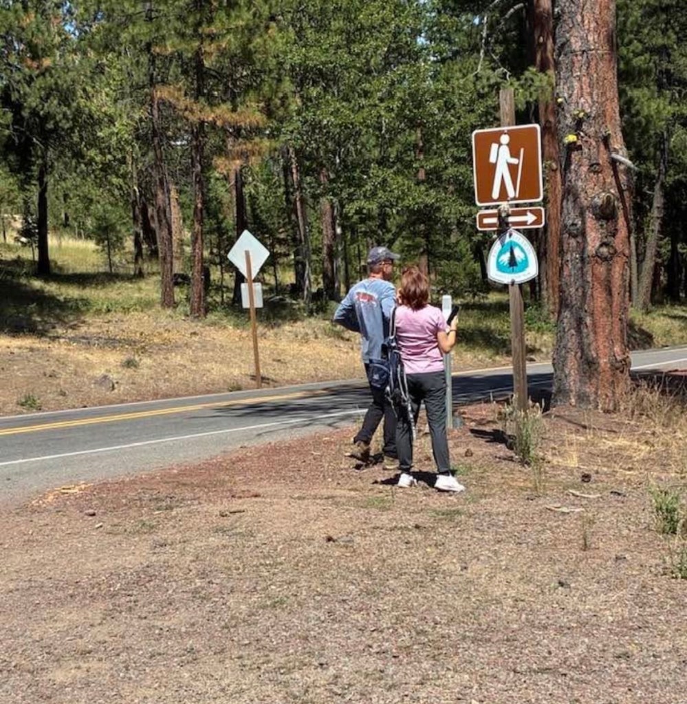
I changed my mind about Keene Reservoir when I got to the road crossing up the hill from it. It’s only about a third of a mile from the highway, but it’s a road walk on a steep, shoulder less, 2-lane highway. It didn’t feel safe, and I wasn’t desperate enough for water to choose that route. I took a break at the road crossing. The folks in the picture above asked me a lot of questions about the PCT. The plates on the vehicle were from a state in the southeastern United States, and their accents matched. I got the impression they knew little about the PCT – completely understandable, methinks. I don’t know much about the area where we were other that the trail itself, but I was happy to share my love of the PCT & the hiker community.
The next water was at a pond about 1 1/2 miles up the trail with sketchy reviews on the FarOut app. I hiked to it and decided against gathering water from it. I kept hiking to the next source – Little Hyatt Reservoir. I forewent the hike around Green Mountain and saved myself a couple of miles of walking by taking the Old Hyatt Prairie Road. There wasn’t much traffic, and the road is gravel so it was easy on the legs.
I ended up camping near the reservoir. There’s a lovely spot near its outfall where I ate dinner than evening and breakfast the next day. I camped about a 5-minute walk from this spot. Just as it was getting dark, another hiker set up their camp nearby. Other than that, it was a very peaceful night. Despite being close to a road it was extremely quiet.
I slept pretty well, but leaving my beautiful breakfast spot by the creek was really difficult. Those miles weren’t going to hike themselves, though. I started off the day figuring I’d stop at Klum Landing Campground. The downside of this is that it left me starting the following day with a long climb, so I figured I’d let my body dictate — if I had more miles in my legs and enough daylight, I would keep going a bit further.
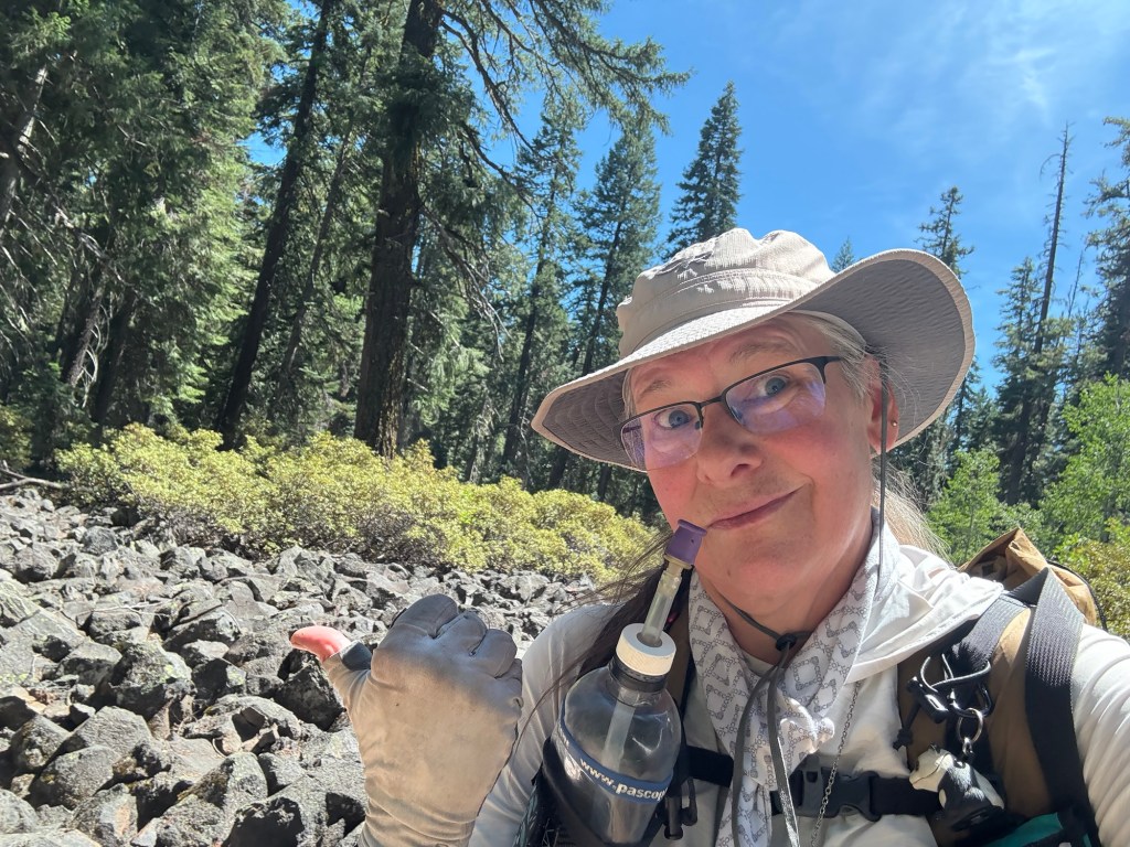
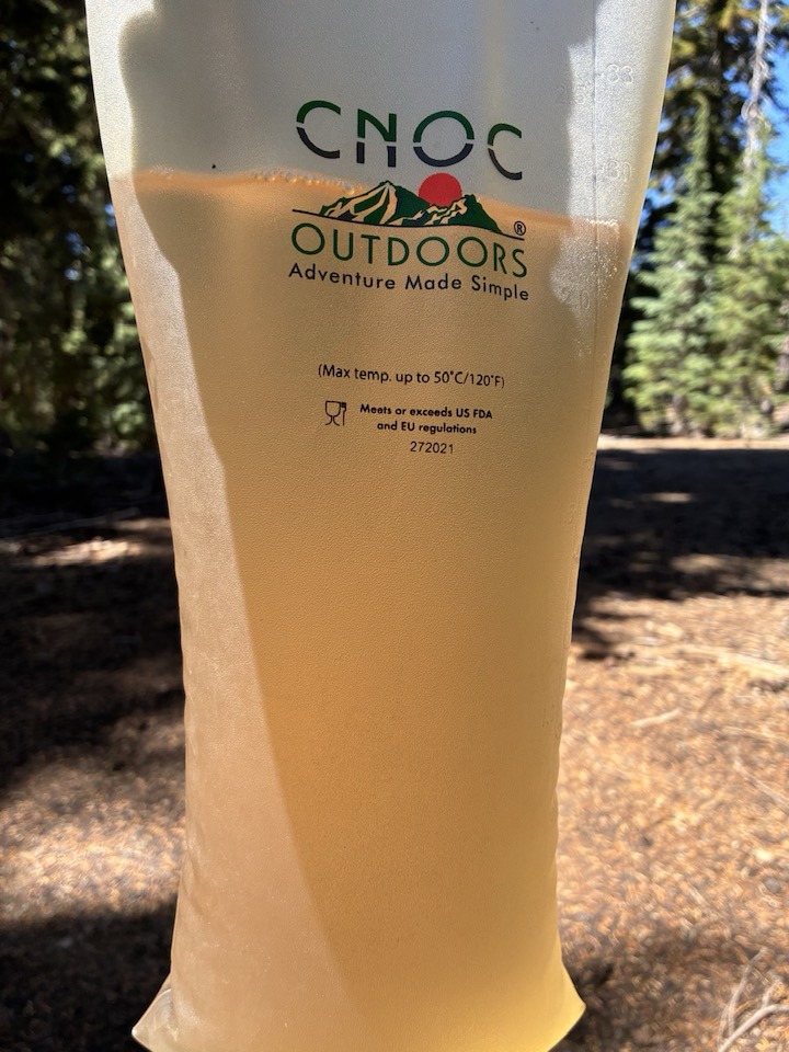
There were several reliable water sources along the day’s path, so I started off the day with just a liter of water. The first water source – a spigot at a horse trough – was shut off because of a broken line. I kept going. The next spot was at a campground about a mile & a half further up the trail. It was a downhill detour to the campground. I was surprised there was no one camping there. I dropped my pack at a campsite and headed to the reservoir to gather some water. The water was … unusual. Near shore, there was a lot of stuff in the water. It was little floaty bits that I struggle to describe. I waded out until the water was up to my mid-thighs in the hopes of clearer water, but nope: I think the enter reservoir is filled with this gunk.
I gathered just enough to get me to the next water source. (Klum Landing has potable water.) I filtered a liter of the water & immediately backflushed my filter with clean water. I wasn’t taking any chances. (I carry chemical treatment as a backup, but the filter gets these floaties out of the water – unless it’s too clogged.)
There were other options for camping and a spot I could have rented a cabin for the night. Much of this day, I was convinced I’d get to the campground, find it was full, and not be able to find a camper who would share their spot. I was struggling physically and I was practically torturing myself with the notion of not being able to find a place to camp. For several miles before the turn-off to the campground I made notes of places along the trail I’d be able to hang my hammock, just in case. (It’s a habit. The FarOut app lists spots for tents, but it’s rare to find a comment about where there are good spots to hang.) I was convinced that because it was a Thursday night in August, the weekenders would already be out in force.
They weren’t. There was no one camped in the loop where I camped. The area I camped was adjacent to the day use area. There’re showers, potable water, and electrical outlets. Absolute heaven!
While the water was in the shower was warming up, put one of my socks over the showerhead to let the water run through it with some force behind it. Ewwwwwwwwwwwwwwwww. The water came out opaque & brown — I washed these socks five days ago and rinsed them out on the trail, I swear!
The only campers in this loop that night were hikers. I chatted with a retired couple who were section hiking the PCT. They’ve almost completed Oregon, and I think they’ve done most of Washington. Another pair of hikers asked if I knew if the water in the spigot is potable. They were relieved to hear it is and mentioned their last water source was “not so good.” I’m pretty sure they were talking about the same water source I drew from earlier in the day.
I had relaxing evening. In the twilight I could see the bats flittering overhead, reducing the local mosquito population.
Day 9
I woke up at 6, used the toilet, then crawled back into my hammock and slept until 8 a.m. It was a leisurely morning. I was planning to make it a short day. Klum Landing is just 22 miles from Fish Lake, my next resupply spot. I’d asked Jim to meet me there the following day (August 10th). I needed to get off the trail for several days. My body was not recovering from the cold I’d contracted more than two weeks earlier — I was beginning to fear I’d developed a sinus infection on top of the chest congestion — and I’m sure it was because I needed more rest. Jim, the dog, and I would camp; one advantage of having him with me was that I wouldn’t have to go through all of the food I’d packed and attempt to do a complete resupply at the Fish Lake Resort. (Resupplying there is possible, but not ideal. The selection is – understandably – limited.)
I ate my breakfast next to the building housing the showers & bathrooms because I was charging my Garmin InReach. I watched a doe with two fawns walk through the quiet campground. The doe was aware of my presence, so I remained still & quiet to allow them to move away at their own pace.
After a relaxing breakfast, I walked back to my campsite. The campsite is uphill a bit, and I was stunned how weary I was. I decided spending a full day here, relaxing, was the better plan. We adjusted our plans so that Jim would meet me a road crossing about eleven trail miles up the road instead of at Fish Lake, but on the same day.
Taking that zero was a great idea! I felt so much better the next day. The chest congestion had lessened, and my sinuses felt a bit better as well.
Leaving the campground, the PCT climbs for seven miles. Shortly after the campground the trail crosses a sizeable irrigation canal. It’s not recommended to take water from the canal even if you’re filtering it because it’s full of agricultural run-off. (Most hikers use filters that trap bacteria; few of us carry a filter that will clear out unwanted chemical waste.) All that fresh, cold water and we can’t drink it. 😔
My first stop of the day was at a spring about four miles up the trail. It’s quite the oasis. The spring is about 1/10th mile off the trail along an easy-to-follow trail. I took a break next to the PCT and hung my water to let gravity filter it. Given the clear area along the trail, shade, and access to water, it was a natural gathering spot for passing hikers. It was a pleasant break. I continued on to my rendezvous point at the highway.
When I arrived, I found a couple of trail angels with cold sodas, fresh fruit, and all kinds of things a person might need out of the trail. I happily took a cold soda and sat & chatted a bit. I knew I had a good bit of time to kill until Jim & Trooper arrived.
Time passed, and no Jim. I had enough food so I wasn’t concerned. As they were packing up, one of the trail angels gave me her phone number and told me to call her if I needed a ride somewhere or anything. She wrote her name on the paper, too, and I recognized she’s a somewhat legendary Southern Oregon trail angel. I knew she meant it that I could call if I needed anything.
After some back & forth with Jim via satellite messenger he said he’d pick me up in the morning. I’ll never really figure out how it went so awry, but he & the dog ended up spending the night in Klamath Falls. I’m wary of spending the night so close to a roadway, especially a highway, but I’m good about camouflaging my presence. Traffic along the road was very light. I was lying in my hammock reading, and because of road noise & headlights I could tell when I vehicle was approaching. I turned out my light each time until well after the vehicle passed. I never felt unsafe.
Jim picked me up the next day. We headed toward Fish Lake. Initially we found a site in a campground. Jim went to the resort to buy ice but came back with a change of plans: stay in a cabin at the resort. The cabins are very rustic, but they’re reasonably priced. The resort had cabins available through Thursday night, which worked out perfectly because my plan was to stay off the trail until Friday. He chose well!
Fish Lake Respite
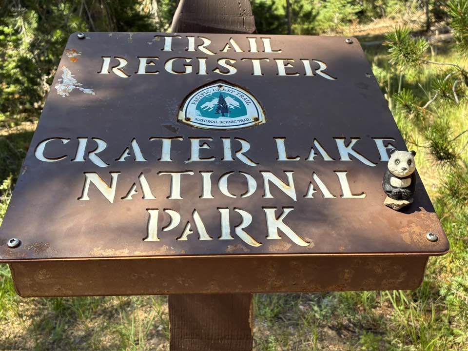
I took it very easy during this break. I walked a bit every day, but just around the resort. We went into Klamath Falls for supplies, and took a trip up to Crater Lake National Park. It was a nice respite. The day before I officially got back on the trail, I took a day hike at Fish Lake. Jim had an errand to run in Klamath Falls, so I figured I’d take the dog with me on the hike to give him some exercise. The dog refused to leave Jim. We walked a short distance from the cabin – just to where the cafe & store are – and the dog stopped. He looked back toward the cabin. He sat down. He wasn’t going anywhere without Jim.
I figure that since I’d been gone for a week for the first time in a long time, the dog decided Jim is the more reliable of the two of us. Trooper went to Klamath Falls; I went on my hike alone.
The next day, we packed up and headed back to Pederson trailhead where Jim picked me up earlier in the week. When we checked out of the cabin, I told the folks in the store they’d see me again later that day or the next day as I’d be returning to pick up my resupply box. Jim asked if I thought it’d be better to take it with us — heck no! why should I carry it an extra ten miles?
Back on the Trail!
I could tell the difference the rest made. My voice was raspy but I wasn’t coughing anywhere near as much and my sinuses were producing far less snot. I felt better overall. I was confident I’d make it back to Fish Lake that day, but wasn’t going to rush it because I didn’t want to overdo it after getting all the recouperation.
I took a break at the Brown Mountain shelter to filter water and have my lunch. There, I spoke with a hiker who was hiking through Oregon as a retirement gift to himself. (I just love all these adventures we “old folks” are.)
Jim sent me a message asking if I was encountering lava fields in the area. The answer is “yes,” and I was hiking through the Brown Mountain lava fields at that time. I sent him the picture below with the message “uh I think so?” This section of the PCT was one of the most expensive to build because of the lava beds.

In one of the lava bed sections, I was maneuvering around a chinkapin that was partially obstructing the trail. Somehow, I tripped. I whacked one of my hands against a chunk of lava. It ached so much I feared I’d broken it. I scraped up a knee and an elbow as well, but the pain in my finger was intense. All because I tried to go around a plant. I kind of hate chinkapins now. (Once the pain subsided, the only damage was a bruise. But dang, that thing hurt.)
I made it back to the Fish Lake area that day. As I was walking along the side trail to resort, I watched a tree fall. There was no wind. The tree was long-dead, and gravity finally won. There was no sound until the lower part of the trunk broke; shortly after that, the trunk hit the ground with a resounding crash. It was a reminder of why we avoid camping near dead trees — gravity always wins that battle, and you don’t always get a warning.
There was a light rain overnight – the first rain I’d seen since my first day on the trail. I planned to get up & get moving and at the cafe when it opened at 8. I was not. To say I dawdled leaving the resort is an understatement. I woke at six but went back to sleep until after 8. I would have stayed in my hammock even longer but I wanted to be in camp by five that night to ensure I had a restful evening and a good night’s sleep. After a leisurely breakfast, then a period of time spent hanging out in the cafe/store sorting through my resupply box, I finally headed out.
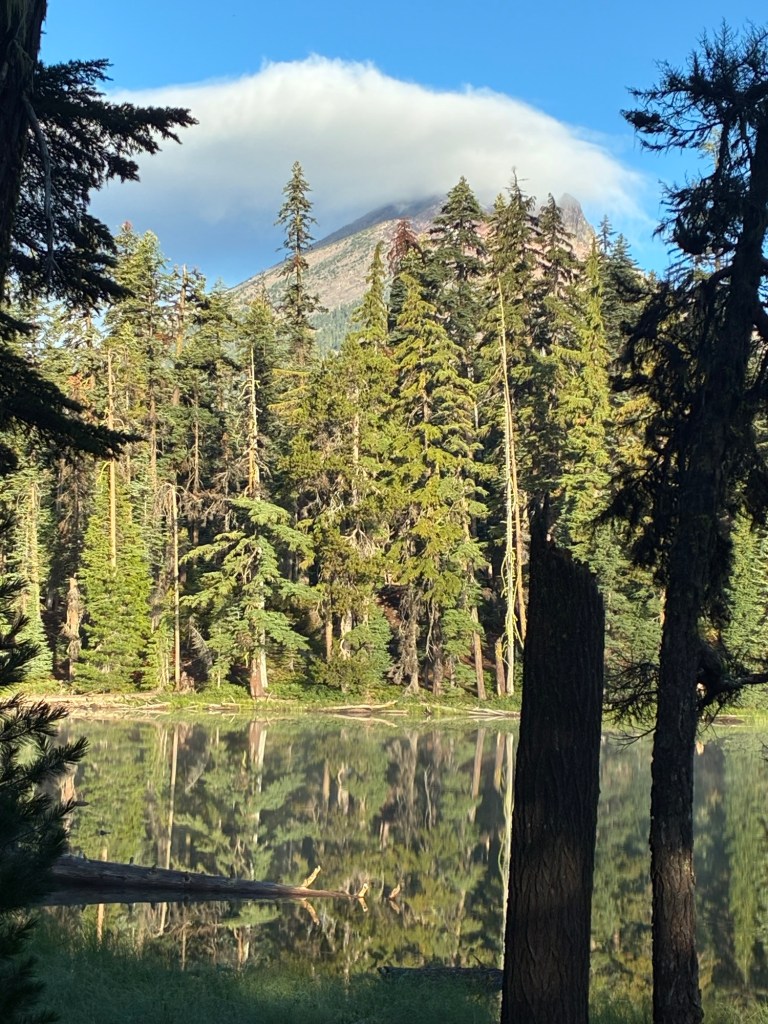
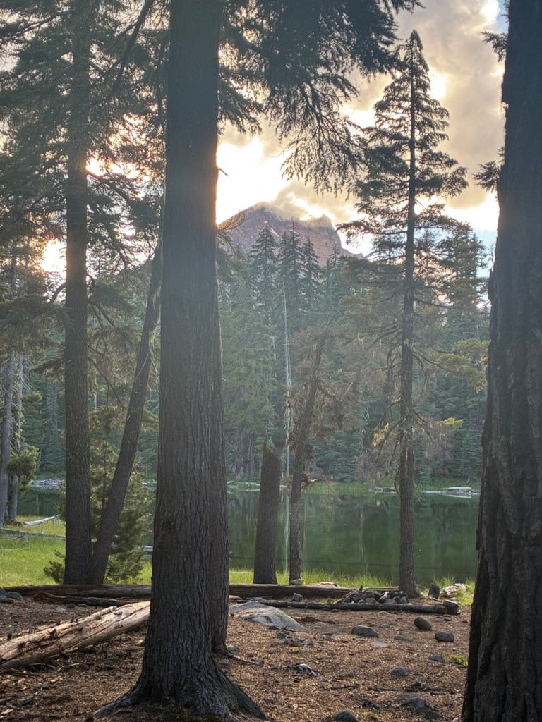
It had been a rainy morning — that’s part of the reason for my dawdling — and I saw lots of wet hikers that day. I had a fairly leisurely day hiking to my intended campsite – Freye Lake. It was a lovely spot to camp. I had a good view of Mount McLoughlin from my site. Some hikers opt to take a day to climb the mountain; clearly, that wasn’t in the cards for this trip. But the spot at this lake was nice enough to set me to thinking that if I ever wanted to climb it, I could spend a week in the Fish Lake area getting acclimated, then a few days at Freye Lake, then up the mountain. That’d work.
Because I’d already given up on the idea of hiking through the entire state – or even back to Ollalie Lake – any pressure I felt was gone. I just needed to make it to each resupply point. That freed me to enjoy myself a little more, to take breaks when I needed them, and to just *be*. The only downside of this day was the realization I’d lost a hiking sock. I take three pairs of socks with me on each trip. One is my camp socks — I call them my ‘foot sweaters’ because Mom knit them. They’re wool, warm, and it’s so lovely putting on a pair of warm, dry, clean socks just as I’m crawling into bed. The other pairs are hiking socks. One pair is on my feet, the other pair is hanging from my pack, airing out. I’m guessing the now-missing sock snagged in some of the brush near Fish Lake. Goodbye, old friend. I will mourn losing you — and not just because I now have one less sock to rotate through on this trip.
I had quite a few neighbors that night, and they were all in their tents & quiet by 8 p.m. I knew they’d be up and out of camp early – possibly even before I was awake. And I was right.
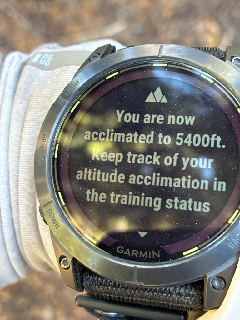
My neighbors were all gone by 6:45 this morning. Taking it easy was paying off: this was a fairly easy day, and my pace felt good. (I was getting close to three weeks at higher elevation, and in addition to the rest & recouperation my body had a lot more red blood cells than it did the first week on the trail.)
I lunched at a mostly unremarkable pond a half-mile off the trail. I went there to gather water, and while the water was filtering I ate my lunch and watched the squadrons of dragonflies flying about. It was a delight. Another highlight? The trail to this pond was lined with ripe blueberries. Normally I limit myself to about a dozen blueberries or huckleberries a day because in my mind that’s the bears’ food, not mind. But this trail looked very much like it wasn’t getting much human traffic so I figured I could indulge a bit more. And I did!
I camped that night at Island Lake. My campsite was less than ideal, but I wandered around for too long trying to find a better spot and I was running out of day light. This lake is on a trail that’s a side trail to the PCT – on the map. Unfortunately, it’s poorly maintained, and the latest reports I could find described a lot of blowdowns & bushwhacking. (This area had a lot of blowdowns along the PCT. It made me really appreciate the work the Backcountry Horsemen of Washington do assisting trail crews in the wilderness areas. We have areas that don’t get maintenance, but so many of Washington’s trails are in pretty good condition, and that’s thanks to trail crews & the folks who use horses to haul in equipment & supplies.) I knew that meant I’d have to backtrack to the PCT the next day, but it was the better use of my energy.
I had a lot of trouble getting to sleep that night, and I slept poorly. I blame the crappy campsite.
I woke about an hour before sunrise and I was cold. I pulled my clothes under my quilt to warm them up before putting them on. (I always do this with my underclothes because putting on a cold bra is a shock to the system.) My poor sleep meant poor recovery. I planned for an easy day. On paper, this was an easy day; to my body, it was hard.
I didn’t make it as far as I’d planned that day. I camped a Snow Lake. It’s a tiny pond just a short distance off the PCT along the Sky Lakes Trail. It was delightfully scenic and a dreadful place to camp. The only place to string up my hammock was right next to the pond, using one dead – but very solid – tree. I knew being right next water would make me feel even colder, so I slept with all my clothes under the quilt.
I slept really well at Snow Lake. As I expected, my tarp was soaked with condensation — that’s the price of camping a meter from still water. I work early but I was in no hurry to get on the trail. That gave my tarp time to dry.
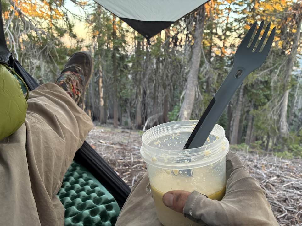
I ate butterscotch coconut pudding with walnuts for breakfast. It was delicious enough that I wrote about it in my journal. It’s not often I eat dessert for breakfast, but hiking is hard work. And given what a glorious view I had while eating, it’s only fitting that my breakfast should be equally inspiring.
I planned for this to be a short day. The first few miles climbed to the highest point of the day; it’s also the highest point I’d been this far. Several other NOBOs stopped at this spot as well. One of them, Avocado, told me she’s hiking the PCT to celebrate her 50th birthday (another one!). She started fairly late in the year (May), and she’d embraced the attitude that she’d get as far as she can because getting a May start date meant it wasn’t likely she’d be able to finish the entire trail this season. She said adopting that view was liberating because she was able to focus on enjoying the hike rather than cranking out miles.
I passed through an area heavily populated with frogs. So many frogs. Unfortunately, I am not sure which kind of frog it was because I don’t have any pictures, but my guess is pseudacris regilla because they were tiny. (I don’t recall a black eye stripe, but it was more than six months ago.) There a lot of them spread out along the trail, but near the streams there were hundreds of them. At one stream, they blanketed the trail. I felt like Moses parting the Red Sea, but only if the Red Sea kept jumping back in the Israelite’s way while they were desperately trying to avoid getting their feet wet. Every step was a challenge and a literal balancing act because I didn’t want to step on any of these tiny little creatures. Unlike the vibrantly-colored ones I see in field guides, these frogs were brown. They were perfectly camouflaged & blended in with the trail very nicely. Great survival tactic if you’re trying to avoid predators that want to eat you; terrible survival tactic if you want to avoid being stepped on by passing hikers.
I camped near Honeymoon Creek. The guidebook I have for Oregon suggests that one shouldn’t rely on this as a water source as “except for the heaviest of runoff years, it’s only a mucky puddle, if anything.” This is how we hiked back before smartphones & apps, children: we read maps & guidebooks, and we hoped for the best & planned for the worst. Winter 2024/2025 left a good snow pack, and in August Honeymoon Creek was running. Where the PCT crosses it, the creek is actually a tiny pond. A flowing stream is readily accessible. (I think most of us prefer to get our water from streams & rivers as it’s often a bit cleaner and thus less likely to clog our filters.)
My set-up that night wasn’t the best. Because of the way the trees & their branches were, it would have been very difficult to set up the tarp. Fortunately, there was no rain predicted and the wind was mild. I got to sleep under the stars.

It was a chilly night but the starry sky was b and I slept well. At this point, I was about 21 miles from Mazama Village. My battery pack was getting low on power. My priority list for keeping things charged are the InReach, my phone, and then my Garmin watch. The watch has the ability to charge through solar energy, so I was hopeful I’d be able to keep it going.
The next water source after Honeymoon Creek is about 7 miles up the trail. It’s a couple of seep ponds a short distance from the trail. This section of trail is through an area that burned a decade or so ago. It’s dry and hot. But I had water, and my body felt good. I took a lengthy lunch break in one of the areas that had some shade. I set my watch in a sunny spot in the hope it’d recharge itself a bit. I laid on the ground with my legs up on a tree trunk. It’s a great way to take a break – lying flat on your back with your legs up (forming as close to an “L” shaped as you can) allows your back to completely relax and it helps to drain some of the excess fluid from your legs. I try to do this anytime I’m taking an extended break.
The break didn’t do my watch any good. It didn’t extend its charge. My best guess is that being directly in the sun allowed it to get too hot, and in that case it won’t charge.
The day ended with me desperately trying to find a campsite before dark. I found a place I could hang the hammock, but it was less than ideal. The slope I was on was steep — at times, I had to grab onto the hammock not slide away from it. (I kept my trekking poles on the ground beneath me to help me stabilize myself getting out of the hammock.) My ultralight camp shoes were worthless – nay, dangerous – on the steep slope. I had to hang within the ‘danger zone’ of a nearby dead tree; I hung my hammock with the head very close to a live tree with enough branches to give me hope that if the dead tree fell during the night it’d be slowed down or redirected a bit, and at least it would miss my chest & head.
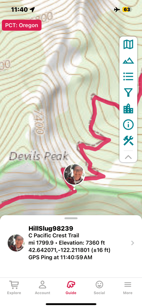
I spent much of the evening pondering. I figured I’d reach Crater Lake the next day, and after much internal debate I decided that would be the end of this hike. Hiking through all of Oregon in a month would be a stretch for me when I’m in good physical condition and have good endurance; this year, it was impossible. I figured that if I intended to continue, I’d want to take a few days off at Crater Lake to recuperate. Leaving Crater Lake, it’s 80 miles to the next resupply. That section has long stretches without water. There’s a 37-mile span in which there’s just one reliable natural water source about mid-way through. Trail angels stock water caches about every ten miles but given my physical condition ten miles between water sources means carrying a lot of water — water is heavy. And leaving Crater Lake, I’d be carrying eight days’ worth of food – also heavy. Adding the extra weight of water & food would slow me down, meaning it’d take a lot of effort for me to hike the 80 miles to my resupply package in Shelter Cove in the time I had remaining. And then we’d still have to go pick up my other resupply box at Big Lake Camp.
I envisioned a situation in which I arrived home with no more than a day to re-acclimate to ‘civilization’ before having to go back to work. That first day back was also our adult felony docket day, meaning I’m in court all day. It would have been too much of a shock to my system.
I further pondered the scenarios in which I decided to quit somewhere between Crater Lake and Shelter Cove. We had enough problems with Jim coming to pick me up at the Pederson trailhead. What if I needed to quit at some random road crossing, and He couldn’t figure out where I was? It sounded like a nightmare I’d rather avoid.
I frequently say “You gotta be smart enough to know when you’re whooped.” So I quit. It was a sad thought, and a part of me felt like a failure. I spent some time working through those feelings and why a person who hiked 130 miles at an elevation she’s never lived at and rarely spends more than a few minutes at would consider such an endeavor “failure.” I found my peace.
I woke in the wee hours of the morning needing to pee. I made my way to the ridge. Atop that ridge, I looked up. So many stars. I was in awe. I cannot begin to describe it. Remember, I was a sailor. I’ve been out to sea, hundreds of miles from land where there’s no smog and no light pollution. On a moonless night out at sea, you can see a stunning number of stars and galaxies. But that was not adequate preparation for the sheer magnitude of what I saw. I could see the Milky Way — I don’t know if I’ve ever seen it, and if I have it was never this clear. I stood there, agape, motionless, until I got dizzy. (Yes, I had already pulled my pants up.) I am still filled with awe, and I hope that the wonder of that moment stays with me as long as I live. Stuff like this moment is why we hike – seeing things we wouldn’t see anywhere but in the wilderness.
(It makes sense that I’d be able to see more of the universe’s twinkly stuff on that ridge than aboard a ship. The air is much thinner at 6700′ feet than it is a sea level. There’s also a kind of humidity haze that clings to the surface of the ocean.)
I wish I could have attempted to take a picture of this, but the battery on my phone was already pretty low and the battery pack gave up the last of its power to the phone. Letting the phone die would mean not being able to take pictures until I made it a place I could plug into an electrical outlet. And even if I got the best photograph possible out of my iPhone, it still wouldn’t have done the scene justice. You’re just going to have to trust me on how awesome it was.
Last Day on the Trail
No Garmin track for this day. My watch was dead, and the battery on my InReach was low enough that I forewent it tracking me to preserve enough battery to allow me to use it to summon SAR if needed. You’ll just have to take my word for it — I hiked to Mazama Village.
It’s about eleven miles from where I camped to Mazama Village, with about 1300′ of elevation gain and 1400′ of descent. I woke with the morning’s twilight to see a bright planet to the east. Not that I was in hurry to get up, though. I slept good, but not great. I ate breakfast on the ridge above my campsite and took in the expansive view to the west of the wilderness recovering from the wildfire. Nature always recovers; unfortunately, a century of misguided land management practices and climate change now means that fires are bigger and more frequent than nature’s natural cycles would allow for adequate recovery.
About three miles into the hike I crossed into Crater Lake National Park. I checked the register. Avocado had come through the day before; Jump Start, Cannonball, and Didi – a hiker I’d chatted with after leaving Klum Landing – signed the register a while back.

I stopped for water at a no-so-secret “secret” pond. There’s no trail to it. It’s on the 7.5 map but not the National Parks Service map. Folks using the FarOut app refer to it as the secret pond. I can understand why the NPS doesn’t publicize its existence. It’s close enough to Mazama Village that people could easily haul in a case of beer for the weekend. Water is scarce in this terrain, and this pond is vitally important to the wildlife. I hesitated to describe it here, but I’m trusting that anyone reading my blog is not the type of person to haul a case of beer into the wilderness, have a giant fire in a fragile ecosystem, and destroy a key resource. Don’t disappoint me. 😉
The last water source was the seep ponds in the burn area, nicknamed Pond 1 and Pond 2 by thru hikers. If Pond 1 was 1 star, and Pond 2 was 2 stars, the secret pond is 4 stars. The water was yellow, but it filtered clear. The west side of the pond had a large shaded area. I took a break there to filter water. While I was there, I noticed three deer on the north side of the pond. They were very wary of me – something I’m delighted to see because that means they’re not overly habituated to the presence of humans. The picture below was the best I could do given their shyness.

It’s three miles, mostly downhill, to get to my day’s destination. The Annie Springs Trail from the PCT to Mazama Village is steep & dusty – I was very glad I wasn’t going to have to hike back up it. (Yay for quitting!) The park allows hikers to camp for free in one section of the campground at Mazama Village. I checked in at the store, bought a cold drink, and then made my way to the hiker area. I set up my camp and cleaned my body as much as I could in camp. (As it turns out, my feet fit into gallon-sized ziplock bags, and that made for a great way to soak the dirt off of them.)
I knew I’d be at this site for a few days while I waited for Jim to return to Southern Oregon to pick me up, so I really settled in. I didn’t sleep well the first night, and I made the following day a decidedly lazy day. I spent much of the morning at the businesses at Mazama Village. Hot coffee & Hot Pockets for breakfast – a meal only a long-distance hiker or a hungover college student can appreciate – charge my phone & my battery packs, bought some souvenirs and a replacement pair of socks. I saw Avocado at the village. She was, as before, very kind and supportive of my decision to end my trip. She was heading out on the trolley that tours the park. I passed on that option and headed back to camp for a nap. Before I dozed off, I saw a young bunk – a deer, not a human – with two velvety horns dart though the hiker camp not far from me. (Most humans were over in the village or elsewhere in the park at that time. It was very quiet.
I returned to the village for dinner. I chatted for a while with Pit, a thru hiker from Western Washington. He resides at a similar elevation, and had similar issues with acclimating to some of the higher elevations when he first started. When I mentioned something about my hammock he nearly jumped out of his chair with delight. He, too, is a hammocker with the same physical issues with sleeping on the ground. He & Cannonball were the only two hammock campers I met, and I got the impression from Pit that the three of us may have been the only ones out here this year.
I told him my reasons for this hike. He told me that it seemed to him that the majority of hikers were either early-to-mid-twenties & just out of college, or women over 50, and he encountered far more retired women hiking solo than retired men hiking solo – the men were much more likely to be hiking with another person. Pit is in his mid-thirties, and he said he doesn’t think he encountered very many other people in the 30-50 age bracket hiking long distances. We agreed it makes sense: folks straight of college and people who’ve just retired have the fewest responsibilities that tie them to one place. I find it delightful to think that women my age make up a sizable percentage of folks out here.
While I was hanging out at Mazama Village, I chatted a few times with a woman who was doing trail magic. She plans to thru-hike the PCT solo in 2026, and she was getting as much information as she could directly from hikers. We talked a lot. She told me that talking to me was encouraging because she was talking to so many young people and she was beginning to worry she wouldn’t be up for the challenge. In many ways, the hardest thing about doing a thru hike or any long-distance hike is getting yourself to the starting line.
Jim arrived on Sunday. We camped in Mazama Village for the night. The next day, we began our meandering trip back to Pasco. We first went to Shelter Cove. We enjoyed a meal on their deck while Trooper napped in the truck and I retrieved my resupply box. We camped that night at Shadow Bay on Waldo Lake. We found the perfect spot for Trooper & us – lots of shade, no neighbors within sight, and plenty of things of Trooper to sniff. That night, he slept parallel with the door, blocking my exit, with his head on my legs. He was not taking any chances. I got up in the early hours of the morning to pee, and he watched me the entire time.
Next stop was Big Lake Youth Camp. We gave a thru-hiker a ride to a trailhead along north of the camp, then headed down the long forest road to the camp. Big Lake looks like a great place for hikers to stop. They have showers, laundry facilities, a hiker box, and a kitchen available. There’s a donation box in the PCT Center; I gave them $10 since most places along the trail charge $5-10 to hold a box for pickup, and everything a Big Lake is by donation. It was a bit bittersweet seeing all those hikers, fresh off the trail, wanting to be one of them. I know I made the right choice to end when I did, but it will always make me a bit sad.
It took me months to start writing this blog, and then more months to finish writing it. The passing time means many of the little memories are lost. The trail journal I wrote really helped, and I plan to keep one on future trips, as well. The memories I’ve retained in my brain stay with me, and they come back frequently. I despise the fact I’m still working, that I have to give up so much of my life to earn a paycheck — I’m there for the paycheck and the pension, and that’s it — so holding on to thoughts of being in the backcountry sustain me.
Next time — we all know there’ll be a next time — I will probably start at Ollalie Lake and hike south. That will allow me to start at 5000′ and gently work my way toward Crater Lake. The downside is starting with by hiking through a lengthy burn area, but with luck that will mean it’ll have had a few more years of recovery. And in the meantime, I get to spend my time dreaming of the next adventure.
