
I’ve delayed writing this blog, and I’m not entirely sure why. It’s been ten days, and I still haven’t completely sorted out my feelings. Relief & a sense of accomplishment at completing what I couldn’t do last year. Discomfort with being out of shape & some of the stupid mistakes I made. Disappointment the weather preventing me from seeing some of the amazing views this section has. Reluctance to admit how often it was hard or sucky or just not fun.
I got on the trail a little before two on Friday. I sent a text to some friends, exclaiming “Off I go!” and soon afterwards thought “Into what?” Great. Nothing like starting a week-long wander in the woods with an existential dilemma.

Lake Susan Jane – the 1st lake after leaving Stevens Pass sobo 
Lake Josephine –
The first day I camped at Mig lake – the place where I ate lunch on day two of last year’s hike. I hiked about 7 & 1/2 miles in just under five hours. I set up camp near the lake & ate dinner, pondering the day’s hike. I figured that if I’d done over seven miles with starting around 2 p.m., I could reasonably do 15-mile days. I could be done in 5-6 days! With that, I drifted off to sleep, content with the day’s effort.
Day 2 was a wake-up call. I climbed Trap Pass in the morning – I’d spent my second night on the trail there last year – and then Pieper Pass in the afternoon. Eleven miles, with 3250′ of climbing & 2845′ of descending. The two passes in one day was a lot of work. It was raining when I arrived at Deception Lakes. I’d intended to camp at the same place I camped day three last year, but it was a pretty awful spot. (I was desperate enough last year to not notice its flaws.) I found a spot with a little bit of protection from the wind & the worst of the rain. It rained quite a bit that night, but my hammock system kept me dry.

I saw a marmot along this section. I love marmots, so I decided that was a harbinger of good luck. 
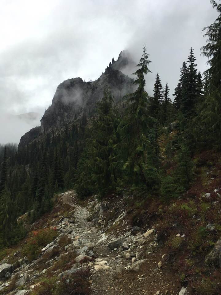
Glacier Lake from trail up to Pieper Pass
I’d really looked forward to Day 3, as I was entering territory I’d hiked a few decades ago. Last year, Deception Lakes was my give up & turn around spot; hiking away from it, heading southbound, was an emotional boost. It was a rainy, cloudy day, meaning I didn’t get to see Cathedral Rock or much else. I didn’t see Cathedral Rock until I was headed downhill, away from the turn-off to Peggy’s Pond & toward Deep Lake.
I camped near Deep Lake that night. There was a good-sized group of nobos at a stock camp nearby with a campfire. I can’t blame them, as the day was cold & rainy. The evening of Day 3 was a repeat of Day 2: get camp set up as quickly as possible, eat huddled under the tarp out of the rain.
Day 4 was a short, all-downhill day. My early hopes of being able to do 15-mile days fell victim to cumulative fatigue & my general slowpokiness getting out of camp every morning. I stopped near a crossing of Waptus River for lunch & decided to camp there. Leaving that spot, there’s a 6-mile, 2400′ climb. It’s a steady 400′ per mile, which isn’t bad, but it’s a near-constant climb for six miles. I decided I’d be better served by taking a short day. That gave me the chance to relax, wash my feet & my socks – bliss! – and make some adjustments to my gear. My tarp even dried out. (Alas, it rained that night, but for a few hours it was dry.)

My camp at Waptus River 
Bears Breast Mountain, taken from my campsite
This was absolutely the right thing to do. The weather forecast predicted heavy rain, beginning at 8:00 a.m. Fortunately, it didn’t start until I was on the trail, but was a morning of hiking uphill in heavy rain. I’m grateful that I was well-rested & in good spirits, as I was able to enjoy the day.

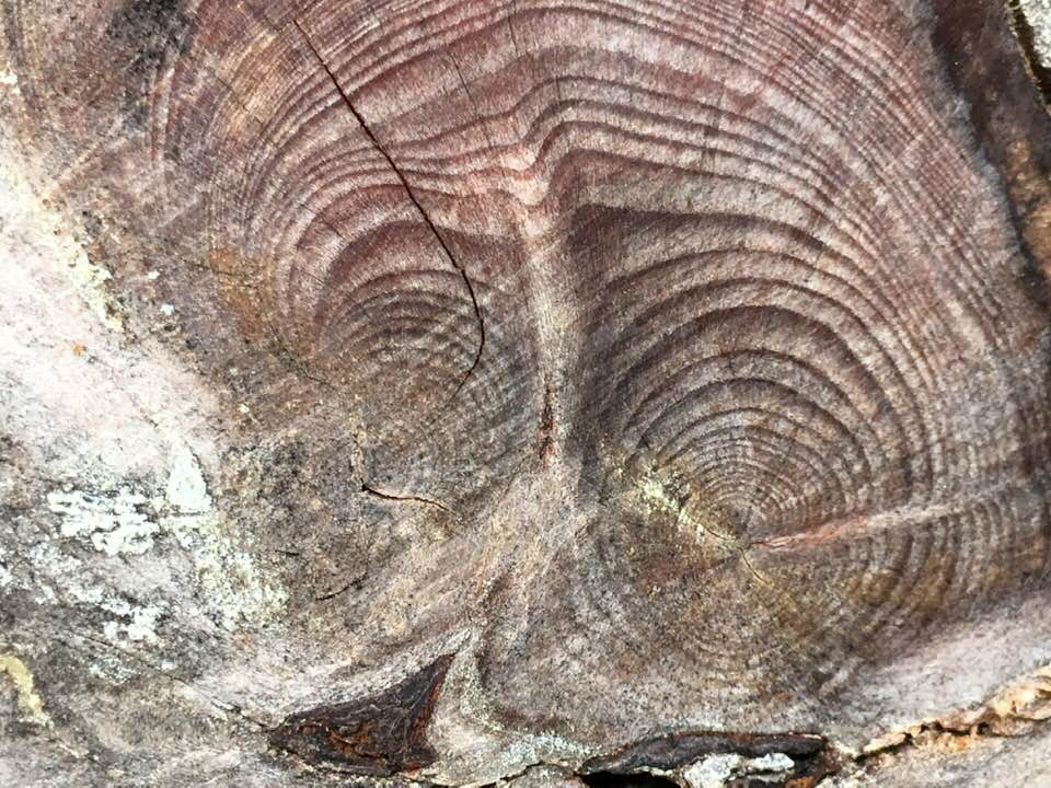
This cut reminded me of She Who Watches
Day 5 was a long-ish day. I camped near Lemah Creek, thinking the crossing would be easier in the morning as the rain was supposed to be lighter overnight. My evening consisted of getting my tarp up quickly, getting my gear situated, switching over to dry camp clothes, and crawling into my hammock. It was still relatively early, but I knew I’d be dry & warm in the hammock.
Day 6 was a difficult & discouraging day. I know I suck at river crossings. I’m okay with wading across, but I’m intimidated by rocky crossings. I don’t “rock hop” well. I could have avoided crossing Lemah Creek by taking the stock detour. I should have swallowed my pride & hiked the detour.
I fell in. It’s not terrible. I bruised my knee, I lost a water bottle & one of my trekking poles in the current. I’d already planned to take a break at the other side of the creek & filter water, so taking the time to gather myself wasn’t a big deal. I knew my down bags would be dry as they were encased in Dyneema stuff sacks, but I checked my camp clothes as the stuff sack they were in is only water-resistant. Fortunately, my dunk in the creek was brief enough that my clothes were dry, too. I was back on the trail before I got too chilled.
This was a rainy day, and there weren’t many views to boost my spirits. Parts of the trail were downright unlovely. But there were some delightful places & moments. I chatted with a father/daughter pair who were hiking Section J northbound; this is her first hike longer than a weekend, and she appeared to be in good spirits despite the rain. The waterfalls on Delate Creek are stunning.
The trail climbed up into the Park Lakes Basin. By then, the rain had moderated and I had bits of sun & some nice views. The basin is large, and I passed up chances to find a campsite because I really wanted to keep going. I paused at a small stream to refill my water bottle and then continued. Shortly after that, I saw a sign warning horsemen that there are no turnouts for the next four miles & no places for packtrains to pass. My spirits sunk. I’d really hoped to get in a few more miles, but I figured that warning meant there’d be no where for me to camp, either. I turned around.
I encountered a couple of nobos that can only be described as “characters.” They were camped just above the basin & had a small fire going. (Campfires aren’t allowed in this area, but given the rain & the cold it’s hard to begrudge anyone a fire.) Cartographer, the chattier of the two, offered me some chili. I gladly accepted. It wasn’t as good as mine, but on a rainy day a stoveless hiker is not going to decline the offer of hot food. Candyman, his companion, had lost all his gear at Snoqualmie Pass to someone who can only be described as a “trail demon”: he offered Candyman a ride to town, and when Candyman went into the travelers’ rest to use the toilet he drove off with all of his gear. Candyman still had his wallet, and he cobbled together enough gear out of the hikers’ boxes in the area to continue his hike.
I mentioned that I’d turned around because of the warning sign, and Cartographer told me it was a wise decision. He started at the Mexico/US border and described the area ahead of me as the worst trail he’d encountered. The trail is rocky, steep, and slow-going. Given my slow pace (about 45:00/mile) and my desire to be camped before dark & to not camp at high elevations when I can avoid it (it’s colder up there), turning around was the right choice.
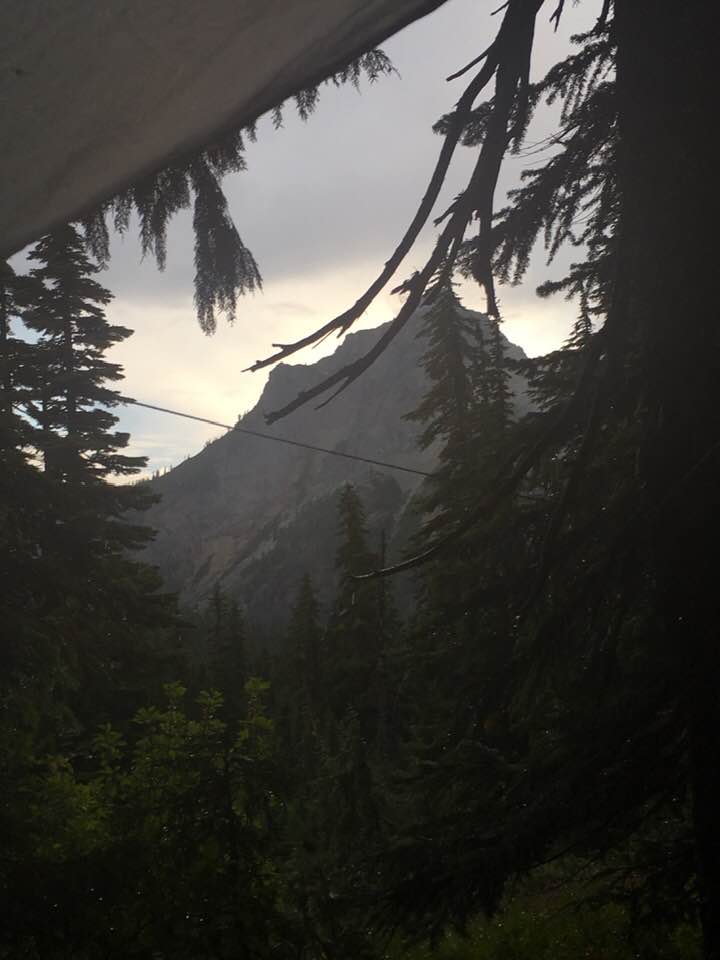
Cartographer & Candy man suggested I try the ridge above them for campsite, and the assured me there were spots for a hammock. I checked it out. It was a fine diversion, but I didn’t find anywhere I wanted to camp, and I didn’t want to continue scrambling around looking for one. It did offer amazing views toward Glacier Lake (the one near Four Brothers, not the Glacier Lake that’s visible from Pieper Pass).

I finally found a campsite just off the trail, still above the basin. It wasn’t a great spot, but I didn’t want to lose all that elevation & have to climb out of the basin again, and I wanted to be camped before dark. While the site wasn’t great, it did offer a nice view of Three Queens. I skipped dinner (because of the chili), put on my dry camp clothes, and crawled into my hammock.
This put everything on Day 7. I was still almost fifteen miles from Snoqualmie Pass, with about 3000′ of climbing & 4600′ of descending. I wasn’t entirely convinced I could do this in one day. Jim was coming to pick me up, so I didn’t want to have him make the drive if I was going to have to spend another night on the trail.
The morning dawned with no rain in the forecast and sunshine. I began my second climb out of the basin and soon discovered what Cartographer was talking about. There’s a lot of scree in the Cascades — they’re fairly young mountains — and the trail was just a thin ribbon through the rock. In some places it was dirt & easy going, but the trail was steep & narrow climbing out of the basin. But it was a glorious morning with glorious views.

I rounded the ridgeline. The trail turned north, away from the sun & into the clouds. I joked with a nobo that we could pretend we were in the Scottish highlands. I saw several marmots through this stretch. (Marmots always make me smile. They’re unbothered by our presence – no doubt because they know they’re much better at scrambling through scree than humans are – and seem curious about us.)

Yes, that’s the trail. 
Spires of Huckleberry Mountain 
Unbothered marmot 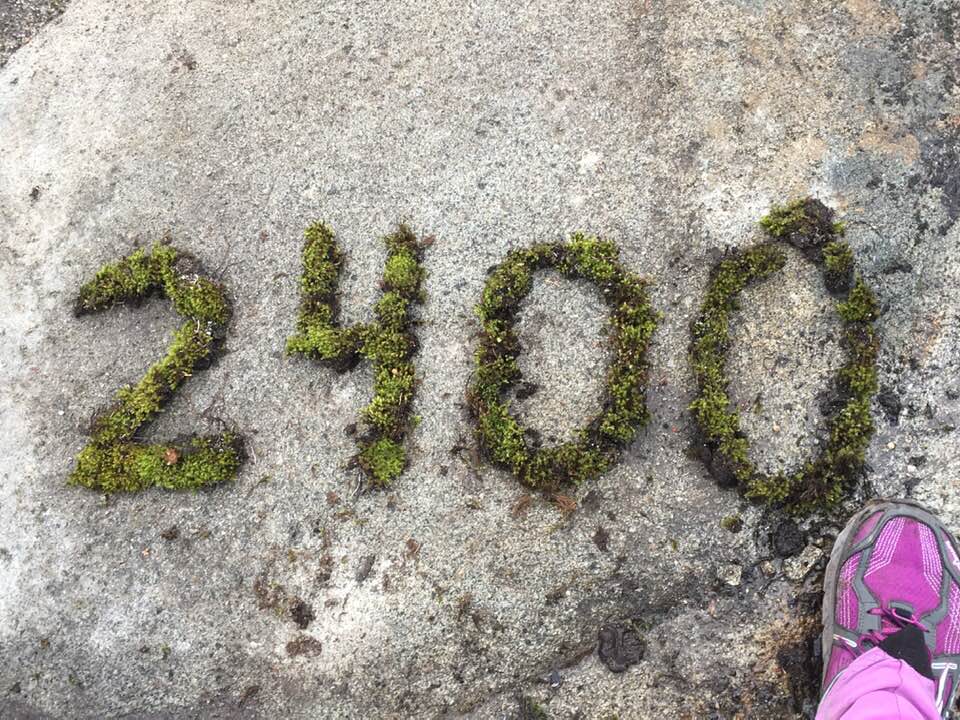
Nobos, Canada is within sniffin’ distance
I paused for lunch – last night’s uneaten dinner – and then started the dash for Snoqualmie Pass. While this day is mostly descending, the first half has about 2200′ of climbing. I was slower than I expected I’d be. I suggested to Jim that I could spend the night at the Summit Inn & he could drive up the following day, but he was willing to wait until I made it to the pass. So I kept going.
There’s a spot along this section, about seven or eight miles north of Snoqualmie Pass, where the trail crosses over an arm of Alaska Mountain. The saddle is only about 10′ wide at that point. The pass is unnamed, but it deserves some fanfare. It marks the end of the worst of the climbing. There’s still about 450′ of climbing getting out of the Ridge Lake area, but it’s almost all downhill from here. For a sobo, this is a moment of joy. This pass deserves a name!
I thought I’d be able to pick up more speed on the descent, but the trail was still pretty rocky. I just wasn’t able to go as fast as I’d hoped, and only having one trekking pole slowed me down. It was dark by the time I arrived at the trailhead. Jim was there, cheering me on.
We drove home that night, as Jim thought it would be best to leave the drive to Stevens Pass to retrieve my truck – and my driving said truck home – for the following day. It was the right choice, as we arrived home fairly late. (Someone insisted on stopping at Miner’s for a burger. That someone is me.) I took a long shower while Jim unloaded the car. I love my hammock, but snuggling with the cats in a real bed was pretty awesome.
In the week & a half since I arrived home, I’ve laundered both my down bags — my feet were wet all week, and ohmigawd were they foul. My gear has been cleaned & dried or recharged and stowed. On to the lessons learned.
1. I need to dial in my nutritional requirements. I packed what I thought was six days’ worth of food. I hiked for seven days. I still had a kilo of food when I got home. I don’t mind carrying extra food — I like the idea of having an extra day’s worth in case I encounter someone in distress — but clearly I was carrying waaaaay too much. I believe that’s partly due to days I snacked all day instead of stopping for lunch (issue #2). That’s not bad, but snacks are heavier than things that need to be cold-soaked.
2. Lunch needs to be something I can keep in my pocket. Because of the rain, I didn’t want to stop to take off my pack & get things out of it. Also, it’s easier to put the pack on if there’s a tree nearby, and that wasn’t always available. I’m comfortable eating & hiking, even if doing so slows me down. (I ate second breakfast while hiking. Even if I’m crawling along at half my usual pace, it’s still forward motion.) And if I want to rack up more miles, I need to stop less.
This will mean re-thinking lunch, as I usually eat something wrapped in a tortilla. Lunches will need to be something I can build while still in camp, or a cold-soaked meal in a container. I’m leaning toward soaking lunch overnight (think burrito filling) & making the burrito while still in camp, then using that container to start cold-soaking either second breakfast or dinner. (I usually start cold-soaking dinner at lunch, but if I’m not stopping for lunch that won’t work.) I can also switch the things that need to be built to dinner & eat dinner meals for lunch.
This will only be an issue if I’m hiking alone. If I’m with someone else, I don’t want to insist we keep walking if they’re inclined to stop for lunch, and it they want to keep walking they can reach into my pack for me & get my lunch out.
3. I need to get better at river crossings. The problem is that I’ll only get better at something that scares me if I do the thing that scares me, and it’s not as if we have a raging, snow-melt fed stream nearby. Solution? I hike to a river or creek & spend the weekend fording it. If my only goal is to cross it, I can do it numerous times, try different things, ponder, and improve. It’s a weird way to spend a weekend but it should help.
4. The Tyvek needs work. It was a loose pack cover, and that allowed my pack to get wet. My trail skirt got so soaked it was useless on the trail. (It still made a good ground cloth in camp.) Perhaps this winter I will work on sewing with the material & getting comfortable working with it. I’d like to make some mittens & a pack cover that fits my pack snuggly.
5. I’m giving up trying to make my 45°F down bag work as an underquilt. Every night I try something different and it just hasn’t worked as well as I hoped. I’m not as warm as I could be, and I’m wasting time when I set up & take down the hammock. I’m most likely going to purchase a synthetic underquilt. I love down, but I can’t shake my paranoia about it getting wet (although that didn’t happen on this trip despite the rainy weather).
6. Going stoveless was a success! While it was relatively warm this week — the overnight lows never got below 40°F — it was dreary & rainy a lot. I was fine with my cold-soaked meals. I plan to change my cold-soak vessel to a “fairshare” mug. The Talenti jar works, but I would have liked more space in the vessel for those meals that needed oil, cheese, or herbs stirred in. I’m considering one of these, but it lacks the vertical sides of the mug or a jar. (Those are easy to scrape clean with my Morsel spork.)
So, what’s next…?
Having completed Section J, I’m looking for next year’s adventure. I’m hoping to hike Stevens Pass to High Bridge Camp. (That’s most of Section K.) It’s a wilder section. It’s about 108 miles, with about the same amount of elevation gain & loss per mile as Section J. I’d like to be able to cover that in about seven days. That means averaging fifteen miles a day. I will need to be in better physical condition than I was this year to do that.
I’m likely to do this in August rather than September. That will likely mean less rain – and thus, possibly less water available along the trail – but also longer days (by almost 90 minutes!), meaning it’ll be easier to average those 15-mile days. It will also mean more thru hikers on the trail, and because I’ll be doing this northbound I’ll be in the throng of nobos.
Based upon the reputation of this section, I’m inclined to do this hike with someone else. There are areas of the trail that sound sketchy and I may feel more confident with someone along for the ride. It might be hard to coordinate this with them — how many other folks can take two weeks off? — and I’m really accustomed to hiking alone, but it might be nice to do something different.
I mentioned my need to ‘dial in’ my nutritional needs. I’ll need to do this for this hike, as I can only fit so much into my Ursack bear-resistant bag. On the plus side, I wouldn’t worry about having no food left in my pack at the end of this hike. Stehekin is just eleven miles from the PCT, and there’s a shuttle from High Bridge Camp to Stehekin. I could arrive at High Bridge with no food, catch the shuttle into Stehekin, and fill by belly with the day-olds from the bakery. While I plan to do this hike in seven days, I would love to spend a few days hanging out in Stehekin afterwards.
As always, the planning is a lot of fun for me. I’ll be spending my spring training for the Millersylvania 50K. It doesn’t have much elevation gain & loss, but that training should have me in pretty good physical condition & ready to tackle backpacking, and I’m hopeful to be relaxed enough in my training that I can spend some weekends backpacking.

Thank you so much for your commentary super helpful! My son and I are planning to do section J northbound in August. Really appreciate your commentary
LikeLike
Excellent – thank you for your comment. I read so many “did this section in three days” descriptions that I like to point out to folks that “hike your own hike” means just that — being a slow poke means I took a lot of pictures & did a lot of pondering. I can do 15-20 mile days, but 10-12 suits me just fine in most cases.
I’ve found writing these blogs helpful because my memory can be selective. In 2020, I planned to do a 110-mile section of the PNT. I quit after a few days. I didn’t know it at the time, but I most likely had COVID-19 several months earlier, and I’d been experiencing a lot of fatigue & brain fog. I attributed those to my deep dissatisfaction with something my boss had done with my job. I was planning to try again in 2021. I’d been attributing the truncation of 2020’s hike to poor physical condition & a weird sense of dread. I read the blog post I’d made right after the hike and recognized I was in or near a bonk both days before I quit. That made me feel a lot better. That section of the PNT has some unique challenges that can make it unpredictable, and knowing ahead of time that I needed to be more cautious about eating enough & at the right time made me more confident. (I ended up skipping the PNT hike to go camping & hiking with The Hubs and our dog instead.)
LikeLike