This past weekend, my friend Jane & I hiked a bit of the PCT in Oregon. Our original plan was to hike along the Washington PCT from Chinook Pass to White Pass, but the weather forecast dissuaded us. (I can deal with days of rain, but my idea of a fun hike is different from most other folks’.) Some last minute scrambling led us to this section of the Oregon PCT.
Our alternative plan started as Lolo Pass to Cascade Locks. This has the advantage of starting at a high point and mostly losing elevation. There are sufficient campsites along this route, and there aren’t any long stretches without water. Ultimately, we truncated our trip. Jane is nursing a sprained ankle, and I’m still dealing with some post-COVID fatigue. Nonetheless, it was a great weekend.
My spouse drove us to Lolo Pass on Saturday. The road to Lolo Pass is something of an adventure: narrow, twisting, somewhat terrifying. It’s basically a wagon road that’s paved. In some places, the vegetation is right up against the road — it’s like driving through a tunnel. There was a fair amount of traffic on the road, including a handful of hardy cyclists. It was slow going.
Because it’s early August, I anticipated we’d be passed by mostly NOBO thruhikers. This year a lot of folks are flipflopping sections because the of the weather. (There’s so much snow in the Sierras this spring that folks who aren’t absolutely confident in the snow travel skills decided to wait until late summer or early fall. Wise decision!) Most of the thruhikers we met were flipflopping sections, but we did meet a few that were intending to hike straight through.
We left the trailhead at about 1 p.m. Saturday. Lots of dayhikers passed us on their way back to their vehicles. After that, we only met a few folks the rest of the day.
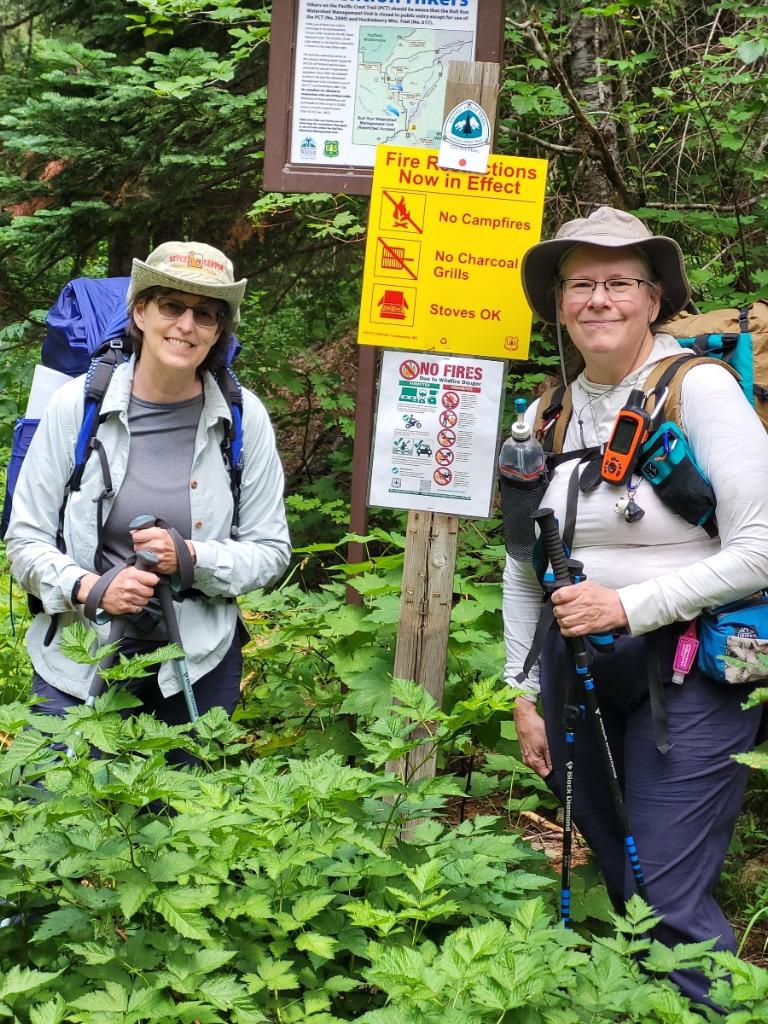


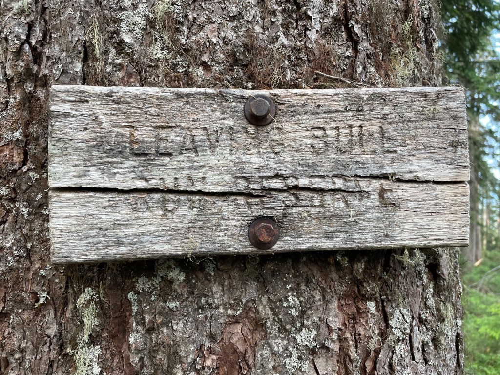
Saturday night, we camped at the junction of the PCT & the Huckleberry Mountain trail. We stopped relatively early because there’s a water source nearby, and because we were both testing our legs. This spot has space for multiple tents and even a few spots for hammocks. We were joined that evening by a couple who are hiking from Government Camp, Oregon, into Washington — I think they said they planned to hike to Stevens Pass.
Generally, the heaviest item in a hiker’s pack at the start of the trip is their food bag. Because this was a relatively short trip, we both decided to bring the commercially-prepared freeze dried meals we owned. (Commercially-prepared freeze dried meals tend to be heavier, require more water, and generally less satisfying than homemade backpacking food. More expensive, too. Go fig. *shrugs*) Jane’s dinner the first night was unpalatable — so much so their neither one of us ate it and we ended up carrying it back to civilization to throw it away. Mine was not great, but I ate it.
We hung our food bags and began winding down for the evening. I was tidying everything up in preparation to climb into my hammock when I realized there was still an apple in my pack. I was not interested in retrieving my food bag, trying to make that apple fit, and then re-securing the bag. I ate the apple, and with apologies to the Leave No Trace gods I threw the apple core as far as I could away from the camp area. (Campsites that are used repeatedly draw critters who learn that humans = food. (Even when we’re careful we are likely to drop crumbs.) And then those critters get bold. Most folks who’ve hiked for a while have at least one story about a really aggressive squirrel or mouse that they practically had to fight off to eat their food.) I picked up other people’s trash I found along the trail and I am very conscientious about keeping water sources pristine, so I hope it all balances out. 😉


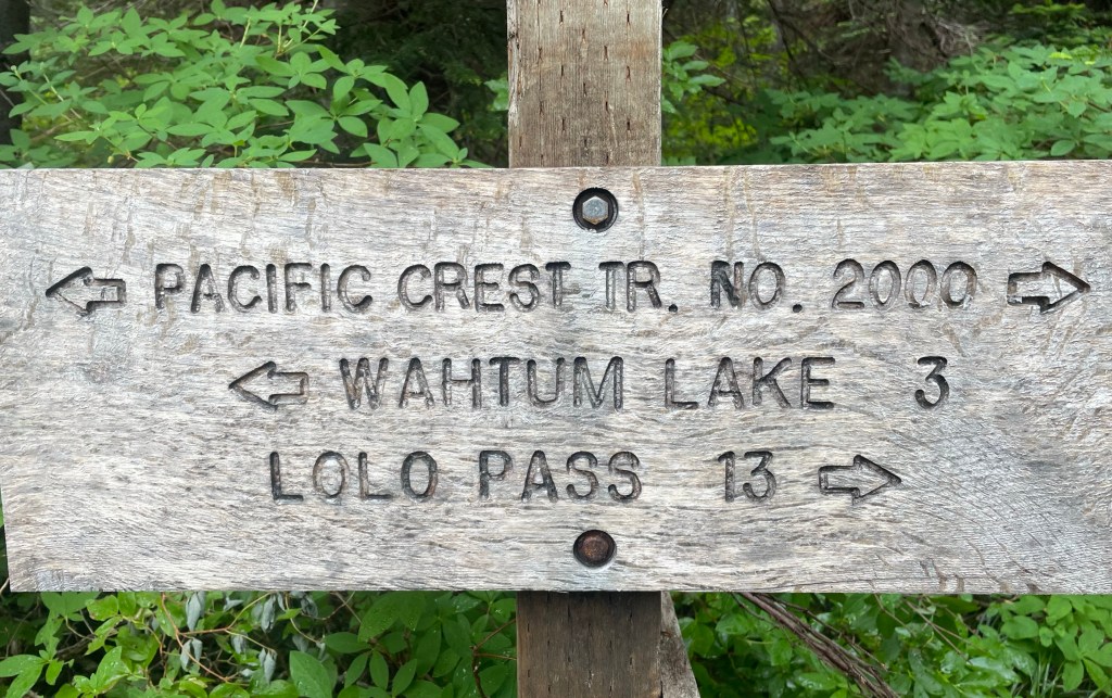
Our initial plan for Sunday was to hike to Wahtum Lake. That’s twelve miles, and it seemed very do-able. After Wahtum Lake, there’d be about fifteen miles left. We could attempt it in one day, or take a short day and then do all the descending the next day. We decided we’d get to the junction at Indian Springs and weigh our options then. As it turned out, we stopped at Indian Springs.


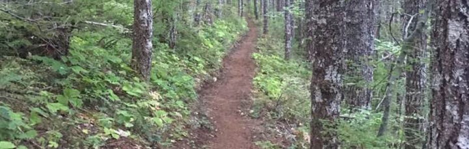
This day was mostly cool & windy. This section of the PCT generally follows ridges. When we were atop a ridge or on the western side of a ridge, we got the wind. When we were in trees or on the eastern side of the ridge, no wind. We got a bit of mist, but it seemed that most of what dripped on us was water from an earlier rainfall coming off of trees. We found a nice open space to stop for lunch. Because it was on top of the ridge, it was quite breezy. There was a small patch under a cedar tree that was dry, and because of diameter of its trunk it provided a nice wind break.


Parts of this trail had numerous blowdowns. A trail crew came through earlier this year and cut what was there at the time. What we encountered were the trees that have blown down since then. We crawled over most and crawled under a few. We also got to watch younger, fitter, spry thru-hikers do one-handed pommel horse vaults over trees that we crawled over. We enjoyed their gymnastic feats and were grateful none of them witnessed our slow, weak crawling. (They’ve had months of practice!)
Dodgy ankles & my fading stamina led me to look for options for truncating the hike. The option we landed on was to have a spouse pick us up at the trailhead near Wahtum Lake. That way, we could camp at Indian Springs on Sunday night and have a leisurely hike to the trailhead Monday morning. Having decided this, we felt less pressure as we didn’t have to hike to Wahtum Lake that day.


We arrived at Indian Springs and quickly located a good campsite. This spot used to be a designated campground. There are still several picnic tables in the area, and the remains of the campground’s pit toilet. (The building has collapsed, but the decking is solid & the toilet remains.) Indian Spring is flowing still, at about the same rate as the picture I posted above. At this spring, instead of a leaf spout, someone used one of the laminated “No Camping” signs. It’s more durable than a leaf. I hope someone removes it before winter sets in. (The winter’s snow is likely to dislodge it, and it will end up somewhere in the forest – where it doesn’t belong.)
Jane retired early. I was puttering about when a SOBO thru hiker passed through the area. He was reading the trail signs, so I wandered over to talk to him. He was asking about campsites further south. I told him we’d already decided to camp here so I wasn’t really looking at campsites over the past few miles, and the ridge line we’d just traversed was really rocky & exposed. I looked at my watch – it was about 30 minutes before sunset – and he said “Yeah – it is getting kind of late.” I mentioned that there were several campsites right around this area & he should look around. He ended up camping in the old parking area — not what I would have done, but thru hikers look for different things in a campsite.
I didn’t get into my hammock until after dark, and I had a difficult time getting to sleep. (I’d only slept about six hours a night the previous three nights.) Around ten PM, I saw the light of a hiker’s headlamp going through the area. They didn’t stop, and I imagine they were headed to Wahtum Lake. Again, thru hikers are a different animal than weekenders like me. (I can’t imagine hiking in the dark or setting up my hammock in the dark, but I imagine most thru hikers can set up their shelters blindfolded.)
We both slept in a bit Monday morning. The sound of thunder got us out of our shelters — this wasn’t on the menu! It didn’t rain while we were packing up, but I packed my raingear so it’d be easily accessible just in case.
Leaving Indian Springs there’s a short incline and the rest is pretty much all downhill to Wahtum Lake. While downhill is easier on the cardiovascular system, I find it taxes my ankles. Fortunately, this wasn’t a steep decline — those are thigh burners! — and the trail wasn’t slippery with pine needles. We got to Wahtum Lake and took a short break. I’m glad we did because the short trail to the trailhead was brutal.
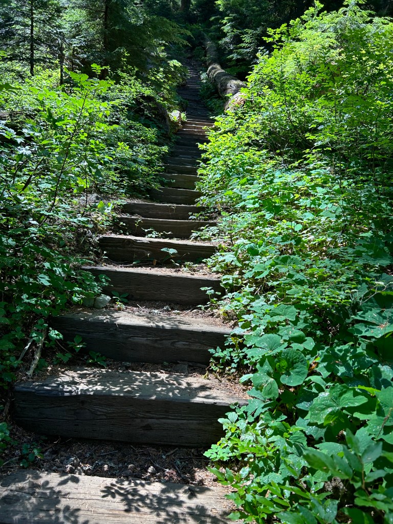

Yep — the trail is almost entirely stairs. My guess is that this trail was originally a game trail and people started using it, and then the US Forest Service decided to “improve” the trail instead of cutting a new trail with switchbacks. This trail is short and steep. Fortunately, it has lots of slow vehicle turnouts where we stopped to enjoy the view.
A short while after we arrived at the trailhead, Jane’s husband arrived to ferry us back to civilization. While the drive from this trailhead wasn’t as bad as the road to Lolo Pass, it was a bit on the adventurous side. We got some lovely views, including this one of Wy’East.

This wasn’t the trip we planned, but it was the trip I needed. I’m hoping to go out for a few overnight hikes over the next couple of months, and then perhaps a couple of weekend trips before it snows. I still have not hiked about half of the PCT in Washington – everything north of US 2 (Stevens Pass) and the section between the Mt. Adams Wilderness & White Pass and I plan to keep working on that goal. Section K (Stevens Pass to High Bridge (Stehekin) or Rainy Pass (Hwy 20)) will likely take the longest as I’ll need to all of it in one hike. (My plan is Stevens Pass to High Bridge, then catch the bus to Stehekin and take the Lady of the Lake to Chelan. I can always come back and do the section between Stehekin and Rainy Pass later. But Stevens to High Bridge will require me to comfortably hike 15-mile days on average. That’ll mean the occasional 20-mile day. I’ve done a 20-mile day, but it was pretty much all downhill and it was my last day on the trail for that trip. (And my stopping point was the first water after nine miles.) I have “test hikes” I can do train for this, and I expect I won’t be ready to hike Section K until 2025. But it’s all time well spent.
