At this point, I’m planning to return to the Pacific Northwest Trail to complete the section hike I truncated last summer. I have two weeks off, and I’m planning to start where I left the trail last summer (the Ryan Cabin/Big Lick trail). That cuts about 18 miles and 3200′ of elevation gain from the route.
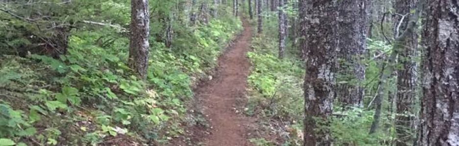
We’re experiencing a heat wave with record temperatures here. It’s not unusual for the Lower Columbia Basin to have a few weeks in summer with highs around or above 100°F. It is unusual for it to be that hot in June, and it’s unusual for the heat wave to last more than a few weeks. Because the summer’s heat hit the Northwest in June, we’re already experiencing large wildfires and record-fast snow melts. It’s a bit cooler in NE Washington, but parts of the trail I’ll be walking are areas that were burned in wildfires over the past decade or so; I cannot count on shade apart from my umbrella.
My concern with the extreme weather is that it may be more difficult this year to access water on the PNT. The PNT is wilder than the PCT, and it doesn’t get the same amount of traffic the PCT does. That means there’s ample solitude, but it also means I’m relying on reports from other hikers that may have traveled the area a few weeks ago.
So I’m pondering knocking out a portion of the Washington PCT instead of the PNT. I was planning to stay off the PCT this year (mostly) because I anticipate it will be as crowded as it was last year after the restrictions were lifted. But I’ve come up with a route that may allow me to avoid the teaming hoards.
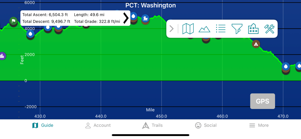
What I’m pondering is this: Start at Harts Pass. Hike to the border, return to Harts Pass. Reload food in pack, hike south to High Bridge. Take bus in to Stehekin. Jim can either treat himself to a ride uplake on the ferry & meet me in Stehekin or meet me in Chelan. Then we go reclaim my truck. This route is 112 miles, but resupplying at Harts Pass makes that a ‘doable’ mileage. (The round-trip between Harts Pass and the border is about 62 miles; the rest of the trip is a very reasonable 50 miles.) This route has about 20,000′ of elevation gain and loss, but spread over that many miles that’s not terrible.
I’m planning to hike Chinook Pass to Stampede Pass in a couple of weeks. If I do that, and the the section between High Bridge and the border in August, that’ll leave me with just 213 miles of the Washington PCT to do. (The trail is 505 miles.) Those remaining miles include two shorter sections – Wind River Road to Forest Road 23 (49 miles) & FR 23 to White Pass (66 miles) – and the daunting Section K (Stevens Pass to High Bridge, 98 miles).

I’m hiking Chinook – Stampede NOBO even though I prefer hiking SOBO. There’re no services at Chinook Pass, but because it’s on a heavily-traveled highway I’d rather wait at Stampede Pass. (Jim will be picking me up.) Hiking that section NOBO means more elevation lost than gained, and given that I’m trying to do 51 miles in four days I’d rather take the ‘easier’ route. It also means we can stop at the Red Arrow in Cle Elum for post-hike burgers (if I get done early enough in the day). Thus, I will be a NOBO. I’ll probably also NOBO Section K, as I’d rather pass my time in Stehekin than at Stevens Pass.
I’ve not made my decision yet. I’ll keep checking the updates for both trails in the Guthook app. I’ll call the ranger district. The PNT is so different than the PCT in the North Cascades, and both options hold great appeal for me. But the important thing is that I’ve recognized a potential problem, and I’m willing to change my plans to avoid it. In the backcountry, that’s a vital survival skill.
