Prior to this hike, I mapped out a roughly 18 mile loop. The hike starts at the Sherman Trail TH on the west end of the loop. That short trail climbs to a junction with the Kettle Crest Trail. I left the KCT at the Wapaloosie Trail, hiked the road to the Jungle Hill TH, then up the Sherman Pass Trail to the KCT. My initial plan included the Columbia Mountain loop, then back onto the KCT to the Sherman Trail.
I arrived at the trailhead before noon. I saw a bear trotting through the woods on my way to the trailhead – a reminder to always store food properly. Upon arrival at the trailhead, the first thing I noticed were cows. There was a cow standing at the beginning of the trail, watching me intently. Nearby, a young steer was approaching me, apparently curious. I saw a group of cattle coming down a cow path towards the parking area. One of them was huge. I then noticed the chest – yep, it was a bull. He stopped, so the group stopped.
The bull began vocalizing. It was a bellow, and my guess is he was communicating with the cow standing on the trail. I looked over and noticed she’d been joined by another young steer. The bull pawed at the ground a bit – nothing aggressive, but I know enough about cattle to know I really didn’t want to give him a reason to become aggressive.
The problem is I’m kind of trapped. The cow is on the trail, where I want to be. I’m between her & her bull. If the bull decides I’m a threat, the safest place for me is my truck; but I have to move away from my truck to get to the trail, and if the bull charges me I have to run toward him to get back to my truck.
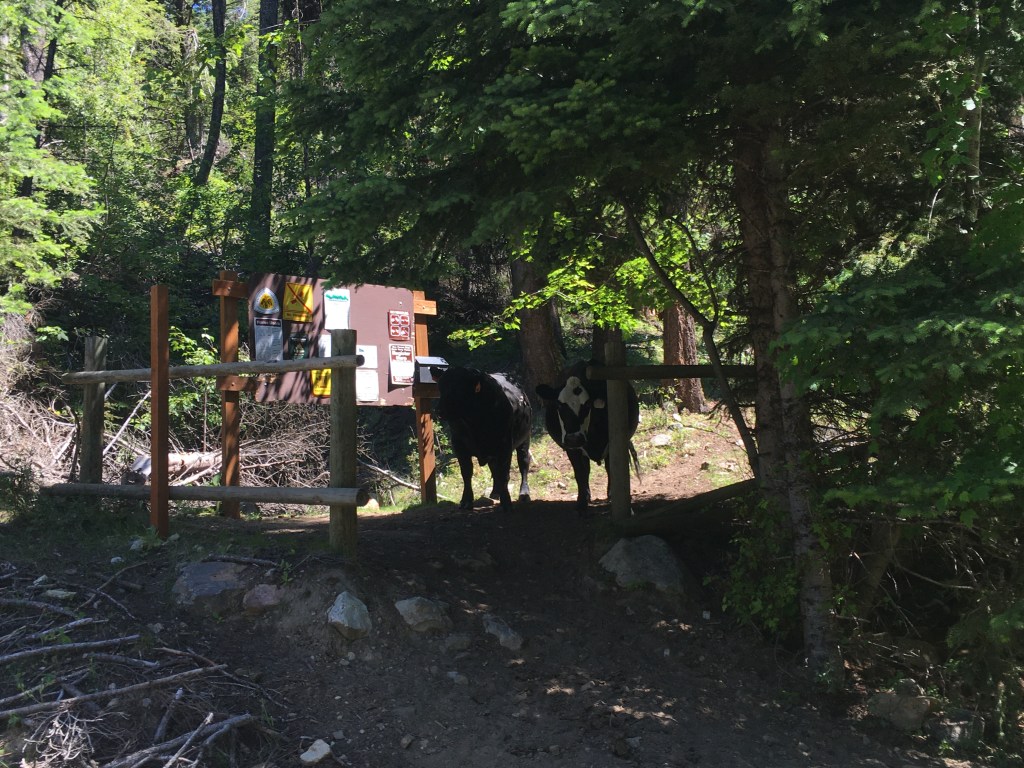
I got everything ready, keeping my eyes on my bovine audience. I knew I couldn’t just walk toward the two standing on the trail, as the bull may regard that as an aggressive move. I ended up walking down the road a short bit & bushwhacking to the trail. The noise I made was enough to move these two off the trail & toward the bull. I figured I was safe at that point, but I kept listening just in case.
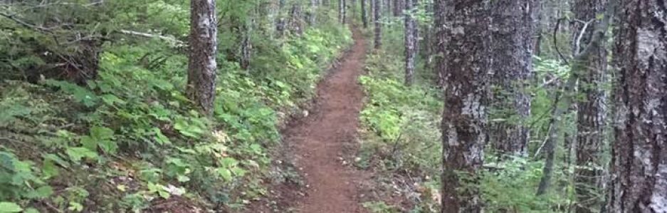
While there are short sections where the Sherman Trail look like a cow path, it looks like some entity has done a lot of work to keep this trail in good condition. It also appears cattle are its primary users. I didn’t see any other humans on this section, and I only saw one boot tread. The trail is short – 1.3 miles – and its primary purpose is to access the Kettle Crest Trail and the road to it is in rough condition, so it’s understandable that it’s not well-used by humans.

As soon as I arrived at the junction, two riders passed me. The KCT is a popular trail, but it’s still far less crowded than trails in the Cascades. (I saw just ten people on the trail Saturday.)
I paused at the piped spring near the junction with the Jungle Hill Trail to filter water. I figured that once I left that spring, my next opportunity for water was the trailhead & campground at Walapoosie Trail. I refilled my bottles & walked away with about two more liters of unfiltered water. I’d rather not carry the extra weight, but I’d also rather not risk running out of water.
From the spring, one climbs along the ridge and is treated with lovely views. I passed the spot I camped a few weeks ago and arrived at a trail junction. Based on the map, I knew it had to be the Wapaloosie Mountain Trail. A moment later, I found the sign.
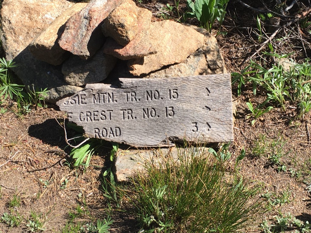
The signpost is gone, but the sign remains 
Sage, wildflowers, and endless views
From this junction, it’s all downhill to the trailhead. The views are lovely at first, then one enters a forested area. This entire area suffered a devastating wildfire several years ago. While it recovers, much of the area is dead & fallen timber. (This can make camping difficult, as there are places that would be otherwise suitable but for the presence of dead standing trees.)

The Wapaloosie Mountain Trail trailhead has a few campsites set up for equestrians. I filtered some of the water I’d carried, the headed for my next stop – Jungle Hill Trail trailhead & campground.

The next section is road walking, but it’s probably the best road walking I’ve ever done while hiking: all gravel, lots of shade, and all downhill. I figured that once I arrived at Jungle Hill, I’d decide if I wanted to push on to Sherman Pass or to camp there at Jungle Hill.
Like Wapaloosie trailhead, Jungle Hill has a camp area designed for equestrians. The campsites are fairly private. I settled in at a one, took a break, and decided to spend the night there. While the map said Sherman Pass is 3.6 miles from Jungle Hill, it’s wrong. I’m very glad I stopped for the night.
My view while relaxing 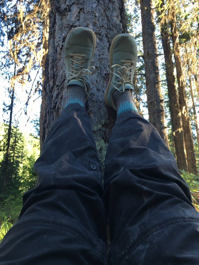
This felt great 
You may notice that those aren’t trail runners on my feet. You’d be correct. A few weeks ago, I regretted not bringing a pair of shoes to wear on the drive home. This time, I wore a regular of running shoes … and forgot to bring a pair of trail runners. Fortunately, these shoes fit well & they’re comfortable. They handled 20+ miles with a 22-pound pack just fine.
This time, I did a slightly better job of setting up my tent. The ground was rocky, so I couldn’t get a few of the stakes into the ground. I used a large rock to secure the front of the tarp & staked out the sides because there was soft-enough ground 3-4′ from the tent. While the site was pretty flat, it did have a slight tilt to one side. That meant if I was lying on my left side, I’d have to brace myself to avoid rolling over. I didn’t sleep well, so I’m more & more inclined to bring my hammock on my upcoming section hike.
One of the reasons I think I didn’t sleep well is I skipped taking a couple of Tylenol & Benadryl before bed. I’ve recently started using full spectrum CDB oil in the hopes I’ll recover and sleep better. There was even a night at home I didn’t wake up once during the night. (That’s a rarity for me.) Alas, my legs were tired & twitchy, I was hungry, and my sinuses were bugging me. I should have admitted defeat & gone with the pharmaceuticals. But that’s the advantage of trying things out on short trips: I won’t make this mistake on a long trip.
The reason I was hungry is I didn’t bring enough food … on purpose. I’m a grazer, and if I have a pocket full of snacks I’ll eat them. I wanted to test myself and my meal planning. A primary mistake was that I ate lunch too early (a couple of hours before I started hiking). I brought a 2-ounce pack of nuts to snack on while hiking. That worked well, and I plan to do so in the future. My dinner only had 610 calories in it. I burned about 1600 kCal during Saturday’s hike. That’s not a huge deficit, but it was enough to make a difference.
I let myself sleep in a bit Sunday morning — when I have trouble sleeping, I seem to sleep best after 3 a.m. — and finally rolled out of bed a little before 7 a.m. Breakfast was another experiment – cold-soaked yellow corn grits with sausage. It was edible but not great. I’ll try again but with hot water. The down side of doing this is that it means there are mornings I will have to heat water for breakfast, and I’ll have to eat breakfast in camp. I’m such a slowpoke getting out of camp I was trying to avoid having to cook breakfast & I like eating second breakfast a few hours after I first get up. But I love yellow corn grits, and I may want a break from granola & oatmeal.
After breakfast, I started lunch cold-soaking. I had two liters of water left, and based upon the previous day’s consumption I figured that was enough to get me to the next spring – two miles past Sherman Pass, where I planned to stop for lunch.
I knew Sunday’s hike was going to be a lot of climbing, and then all downhill back to the truck. While it was a cool morning, I was grateful for the shady trail. I saw no humans on this section of the trail. At a little over three miles in, I was approaching a stream when I heard movement in the underbrush – it was a moose! He wanted to get away from me, and I didn’t want to distress him any further, so I didn’t attempt to take a picture. I’ve never seen a moose in the wild — seeing one standing alongside US 2 in Idaho doesn’t count — and this was the closest I’ve ever been to a moose. Because he moved away slowly, I think he was cautious, not scared, and I’m so grateful I got to see him.
Based upon the map’s description that the Sherman Pass trail was 3.6 miles, I figured I was close to Sherman Pass. Nope – I still had more than a mile to go. Upon arrival, I realized the best spot to eat lunch was sitting on a large rock right next the trail. (It was shaded & in the path of a lovely, cooling breeze.) Lunch was brownie batter hummus with Belvita biscuits. It was certainly calorie dense – about 1000 kCal. That was warranted, but it would have been smarter to spread those calories over a few hours instead of eating them all at once.
With a full belly, I started back on the trail – very slowly. I wanted to give my body time to start digesting lunch. I still had a liter of water left, and I decided to forego re-filling a bottle at the spring two miles later. I also forewent the Columbia Mountain loop. The extra mile-plus in the morning combined with my tiredness made getting home my priority.
The bugs started to get bad through here, too. It wasn’t like that two weeks ago, and it wasn’t like that the day before, either. I kept getting buzzed by horseflies, some large black bee, and the occasional black fly. It was motivation to keep moving forward.

Lovely shady section of trail 
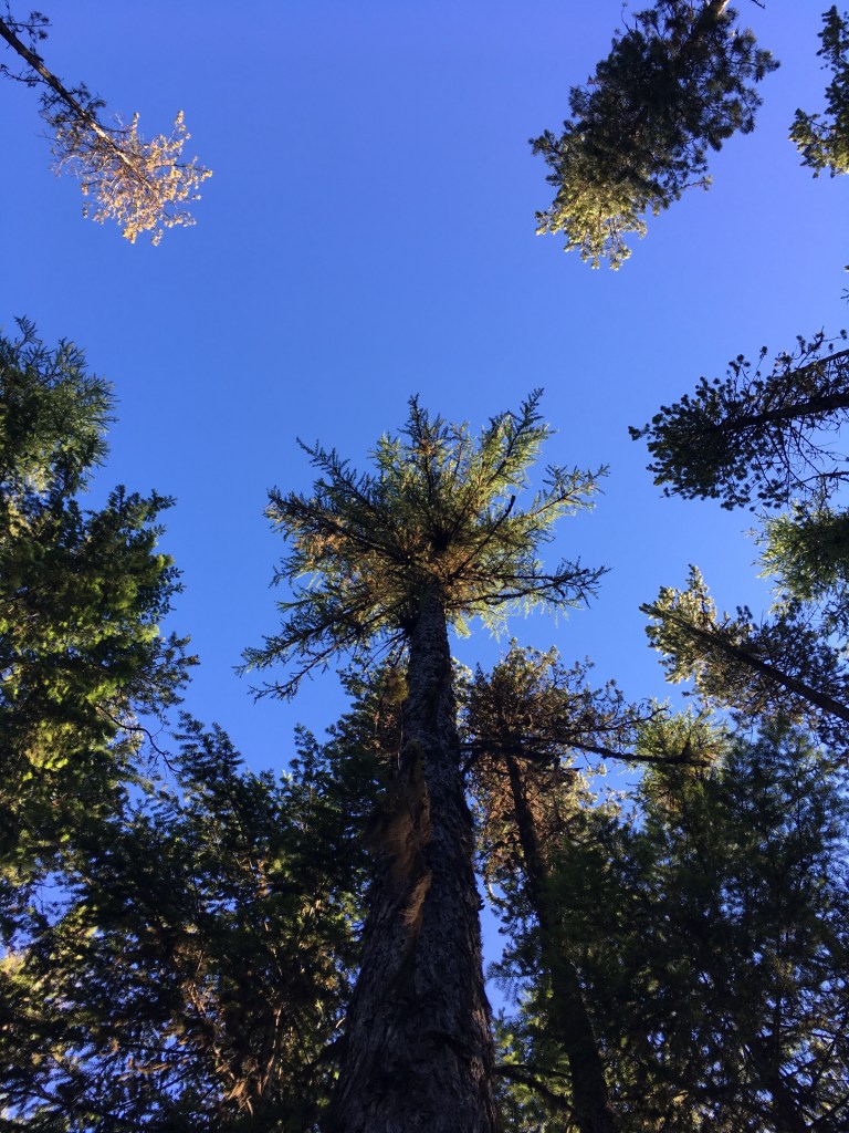
That’s one cool tree
I made my way to the high point of the day’s trek and then downhill I went. There was no cattle waiting for me at the trailhead, and I still had a bit of water left.
One new thing I tried on this hike that worked well is my adapted water bottle, shown below. Because the space on my shoulder straps is short, the water bottle holder is a bit too high for me to grab it easily. (This pack doesn’t have water bottle holders. It’s from an era when people didn’t drink water, apparently.) I don’t want to use a hydration bladder, but I know I drink more frequently when I have that tube conveniently located. I took the tube from a hydration bladder I don’t use; its connector is the same size & thread as the cap of a water bottle. (I usually shove the tube as far down into the bottle as it’ll go. It’s not usually as tall as it appears in this picture.) This makes drinking water easier as I don’t have to stop.

I also used a set of Pacerpoles for the first time. They arrived Friday, so I didn’t have an opportunity to read through all the literature & divine if I’m doing everything right. Nonetheless, I like them. They reduce the strain on my wrists and possibly arthritic thumb. I’m looking forward to using them on future hikes.
With two liters of water, my pack weighed 22.2 pounds at the trailhead. I was missing a few things — I really need to make a checklist pre-hike! — but that’s a decent weight. My new backpack is on its way here; that’ll enable me to drop a few more pounds from my base weight.
It doesn’t look like I’ll have the chance to do another overnight hike before heading out on my section hike. I need to get my food prepared and make a list. I need to set up the stuff Jim will bring to my re-supply in Northport. I found myself considering this upcoming hike with some trepidation. I’m not in as good of physical condition as I’d like. I’m hiking somewhere unknown. I think my lack of confidence at work is spilling over into other areas of my life, and it would be terrible to let that ruin this trip. The first section is about seventy miles – shorter than Section J of the PCT – with a more forgiving grade per mile. The trail may be wilder and more remote, but I’m experienced in the backcountry. I’m comfortable with my gear, and I know what I’m doing. I need this trip, and I’m excited.
Now – time to get to work!
