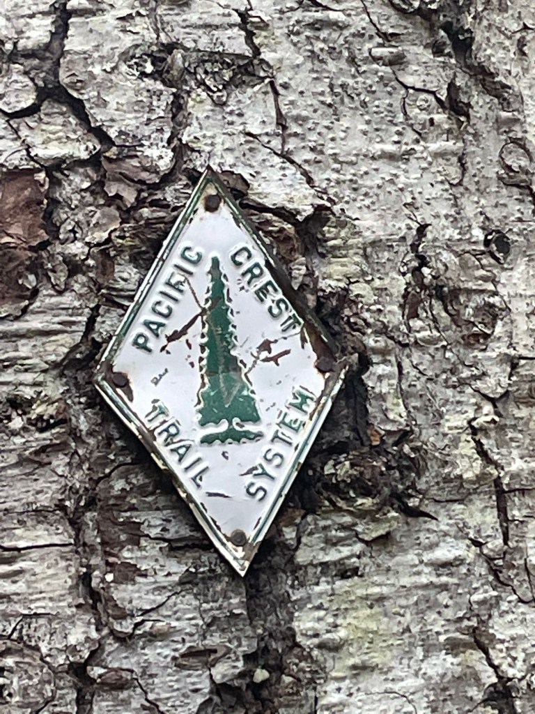
I headed out to hike the remaining 74 miles of Section H of the Washington PCT. This was a somewhat impromptu hike, as I’d planned to be hiking Section J with a friend. Alas, she contracted COVID-19. I figured I’d go knock out some miles along the PCT I’d not previously hiked. Land of the Cowlitz, Klickitat, Siletz, and Yakama Nations.

I decided to quit by noon of the second day. It was a reminder of the importance of sport-specific training: I’ve been running a lot, but running taxes the body differently than walking while carrying a 25-pound pack. And I’ve not been running hills because I’ve been focusing on keeping my heart rate between 110-130 bpm. My legs were completely unprepared.
The first day was fine. Jim dropped me off at Big Mosquito Lake shortly after 1 p.m. Monday. On the drive to Big Mosquito Lake, I saw a few points of interest on the map that I hadn’t noticed in previous trips through the area. We stopped at the Basket Tree Interpretive Site & Langfield Falls. Basket Tree Interpretive site has a couple of large cedar trees from which the bark was stripped. A sign described all of the things indigenous people would – and still do – make from the bark & underbark. The sign also noted that while bark-stripped cedar trees are found from Alaska to Idaho, the largest concentration of them are in the Gifford Pinchot National Forest.
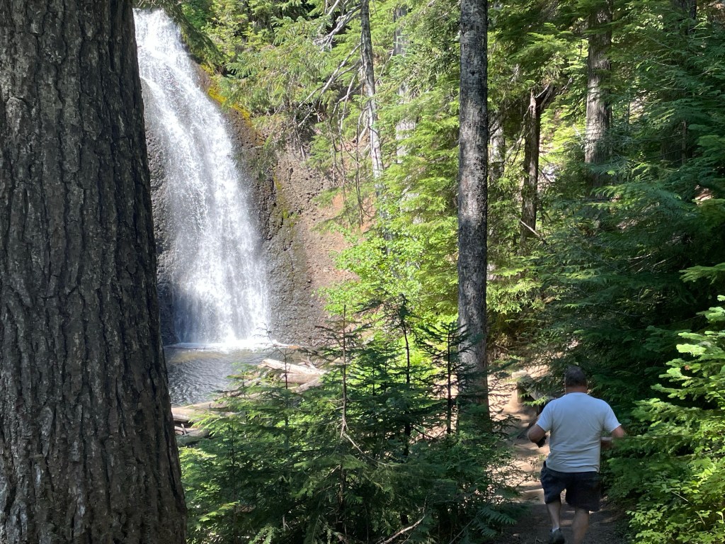

Langfield Falls was also a worthy detour. A short walk to the plunge pool of a lovely waterfall and interesting geology. Jim expressed concern about delaying the start of my hike, but we agreed the two stops were worth the time.
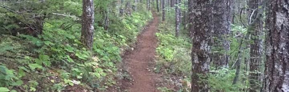
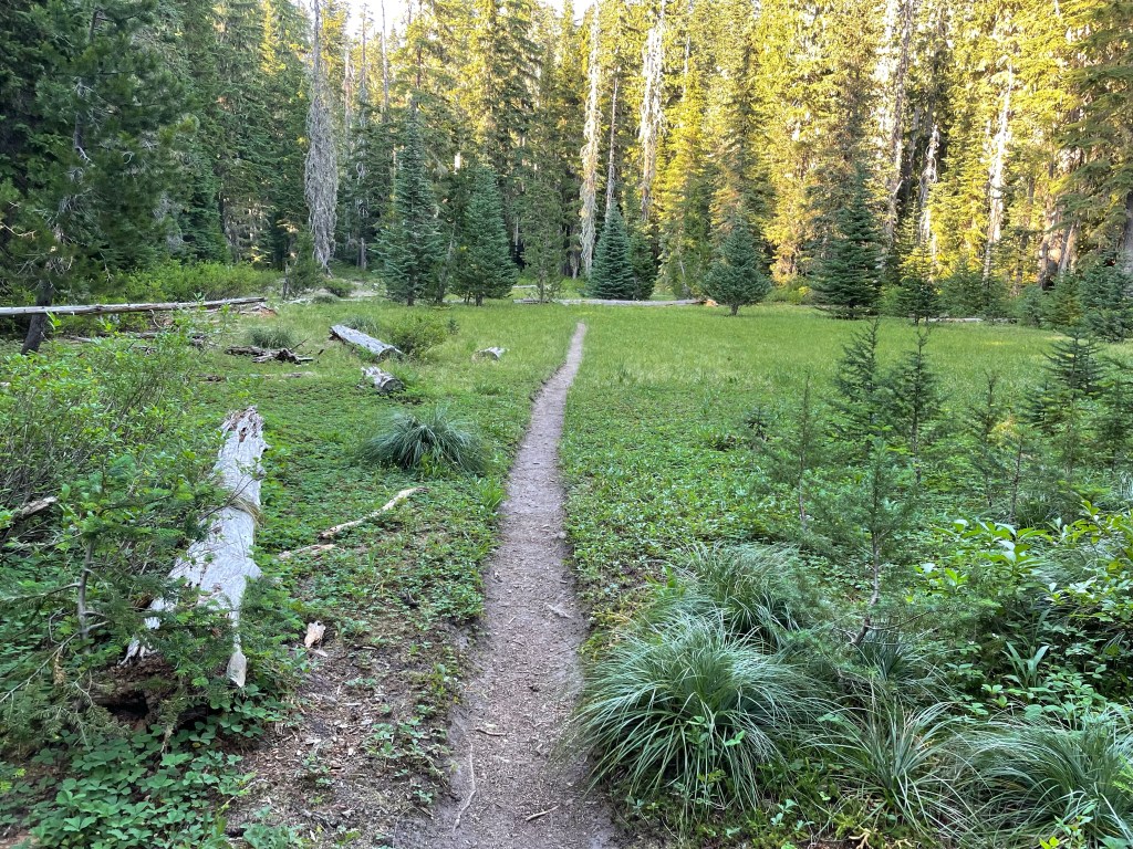
In the first quarter-mile or so on the trail, I passed about a half-dozen thru-hikers taking their afternoon break. It was the heat of the day, so they can’t be faulted for taking a nap or just getting off their feet for a while. This area of the PCT is close to the small town of Trout Lake, and Trout Lake has fully embraced its role as a resupply point. Locals run shuttles to & from the trail, and the local cafe and grocery store are very hiker-friendly. Trout Lake has become a must-stop place for thru-hikers. Because of this, the hikers on the trail in the area are frequently either waiting for a shuttle to town or have just returned from town.

My Garmin Fenix 5 is beginning to show signs of its battery’s imminent demise – GPS tracking can drain it very quickly. I decided ahead of this trip I’d use the InReach & the app on my phone to tell me how far I’d hiked. Navigation on the PCT is pretty easy (most of the time), and I don’t need to know exactly how many feet I walked and how many feet of elevation I gained & lost during a day. (I want to know it, but I don’t need to know it.)

I planned to take a selfie every mile on the trail, like I did when I hiked Section J in 2019. But because I wasn’t using my Garmin to track this hike, I found myself obsessively checking the FarOut app to see how far I’d hiked. I was spending too much time staring at my phone, so I stopped doing the mile selfies.

I spent the first night near White Salmon River & Road 23, about ten miles from where I started. I had to get to that point because I needed water, and it was a good place to stop for the day. I was surprised to see the camp area close to full given that it was still relatively early — thru hikers tend to hike until very close to sunset — but I’m guessing a fair number of them had just spent the day in Trout Lake & wanted to rest up while digesting all that town food. (It’s referred to as a “nero day” — “near zero.”)


There was one spot in with the tents where I could have hung my hammock, but it would have broken up the easiest path through the camp. I decided to hike a bit further. (There’s another water source about a mile up trail; I still had enough water & daylight to keep going.) I found an okay place to hang my hammock where no one would put a tent — the ground was too uneven. I didn’t bother hanging the tarp because it was quite warm and no rain was predicted overnight. Dinner was cold-soaked spaghetti with Italian sausage. (I didn’t bring a stove because of how warm the weather is, and I generally cold-soak my food regardless. The meat stays a bit crunchy, but a hungry hiker doesn’t care. Oil & cheese make everything delicious.) Pre-trip, I packed my Ursack somewhat haphazardly. In camp, I reorganized it a bit & put what I planned to eat the next day in the top of the bag, and then tied it to a tree a ways away from my camp & the neighboring camp. I laid on the ground for a while with my feet up on a tree to try to drain some of the fluid from my legs. This always feels so magical!
I struggled to get to sleep that night — I rarely sleep well the first night on the trail. But it felt amazing to by lie in my hammock, feeling the breeze move over me. I saw a few flashes of lightning overnight, but I didn’t hear any sound. We’re getting close to a full moon but between the way I had my hammock aligned & the tree cover, the moon wasn’t too bright for me to sleep. (I once yelled at the moon for being too bright. Yes, I think that’s ridiculous, too.)
I woke at about 5:30. I like to lie about in the hammock for a bit before starting my day. It gives the time to read morning prayer, stretch my muscles, rotate a few joints, and generally see how my body feels. My body had a lot of feels. My glutes were feeling weary over the last few miles of Monday’s hike, and they weren’t exactly happy the next morning. My feet & ankles were weary. My calves were tired. Nothing achy, just weary. I knew the day would start with two miles of climbing – never my favorite way to start the day – so I started slowly. Very, very slowly.
My plan for day two was to hike to Adams Creek. It’s about 13 miles from where I camped the first night. I usually average about two miles an hour, so I figured I’d get to Adams Creek in mid-afternoon. Reports are that Adams Creek is running high & fast; given my sketchy balance & questionable water crossing skills, I wanted to get to the creek & evaluate whether I should cross it then or camp nearby & cross it in the morning. (Snowmelt-fed creeks tend to be highest in the evening because of the day’s heat.) But I didn’t get that far.
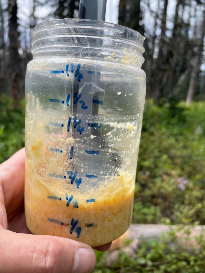
After that initial climb, there’s another three miles of climbing with one pitch that felt particularly steep, and then another four miles of climbing. A good chunk of this part of the trail goes through an old burn area. There’s a spring a short distance off the trail that is, as one FarOut user described it “a full on creek coming out of the ground.” The burn is probably a few decades old so the land is well on its recovery path, but the spring is an oasis. Hikers have created a small area off the trail for folks to take a break. This area is about 30′ from the spring itself, so the spring isn’t getting trampled. (The water is shooting out from some rocks – full-on “Moses in the desert” – so the spring is naturally pretty protected.) The day was warm and muggy, and that cold water was a blessing. I took advantage of how cold the water was to make some pudding. I like pudding, but I generally don’t get excited about it. While hiking? Pudding is ambrosia. It’s divine intervention. It’s just perfect.
Elevensies 😍😋
It was the thought of another four miles of climbing that did me in. I tried everything to boost my spirits. I was eating pudding – how much better can life get? I sang show tunes. I sang sea shanties. I reminded myself that Second Chance started off his PCT thru-hike attempt doing four-mile days. I reminded myself that even if I was only moving at 1 mph, I’d still make it to Adams Creek by 6 p.m. – plenty of daylight left. I told myself how horrible I’d feel for quitting too early. I quit anyway.
I don’t think I was even making 1 mph going up that hill. It was just too much. I felt like crap for turning around. I figured as soon as I turned around, I’d start feeling good & then I’d question my decision to quit. That didn’t happen — even on the flats & gentle descents, I was moving pretty slowly. I took a lot of breaks; they helped but only minimally. Turning around was the right decision. I could have kept going, and in a few days my legs probably would have been fine. But this wasn’t the start of a thru-hike (almost everyone suffers the first few weeks of a thru-hike). I expect some part of a multi-day hike to suck, but there’s a limit to how much of misery I’m willing to tolerate.
Jim picked me up – at about 6:30 last night where he’d delivered several thru-hikers the day before – yay trail magic! We got home late, but I was still able to wish Trooper a happy birthday. (The Puppymonkeybaby is two years old!) I skipped the ibuprofen for my achy legs but I was able to sleep okay last night. My legs are pretty weary still, and I guess I’m reminded that I cannot head out on a week-long hike if I’ve done no hiking in the previous few months. I’d planned to wear a pack with about 20 pounds in it while walking the dog, but I haven’t. I paid for my sloth. I’m hopeful I can get back out on the trail in the next day or so – something shorter with less elevation gain.

Right now I’m doing laundry & looking at trail maps. My legs are stiff as all get-out, but when I carried my pack back into the house this morning it didn’t feel like death. And it’ll be lighter if I’m carry 2-3 days worth of food rather than 7-8. Another good night’s sleep & I’ll be ready to go!

Glad you are safe
LikeLike
Thanks! It was a good learning experience. Time in the backcountry is never wasted, and I figure I might as well learn something from suffering.
LikeLike
Glad you are safe! You were wise to turn back. And TroopDog is happy both his people are home.
LikeLike